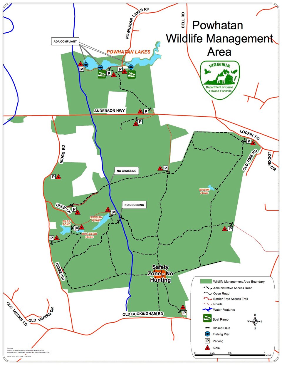
Only 25 miles west of Richmond and conveniently reached from U.S. Route 60, the 4462-acre Powhatan Wildlife Management Area provides a haven for outdoors enthusiasts near an expanding metropolitan area. The area’s landscape of old fields, cultivated areas for habitat enhancement, wood lots and lakes provide for a diversity of wildlife species.
Once part of several farms, this gently rolling upland is well drained by several small streams that slowly make there way to Sallee Creek. Sallee Creek traverses the area northward on its way to the James River. Due to the past farming use of the area, and some of the current wildlife management practices of burning and disking, much of the area is in open fields. These openings, along with mature and newly emerging forests assure a diversity of wildlife cover types. The area’s acreage is contiguous although divided by Route 60 and has one privately owned interior property. Water on the area includes, four “farm” ponds and the twin Powhatan Lakes along with numerous beaver ponds and marshes along Sallee Creek. A small waterfowl impoundment exists just east of the crossing of Salmon Creek and the CCC trail. Elevations on the area range from 200 to 350 feet.
Hunters will find a diverse set of game species on the Powhatan WMA. Deer and turkeys abound throughout the area and the moist soil and water around the beaver swamps are particularly attractive to woodcock and wood ducks. Small game hunters may pursue quail, rabbits, and squirrels within their preferred habitats.