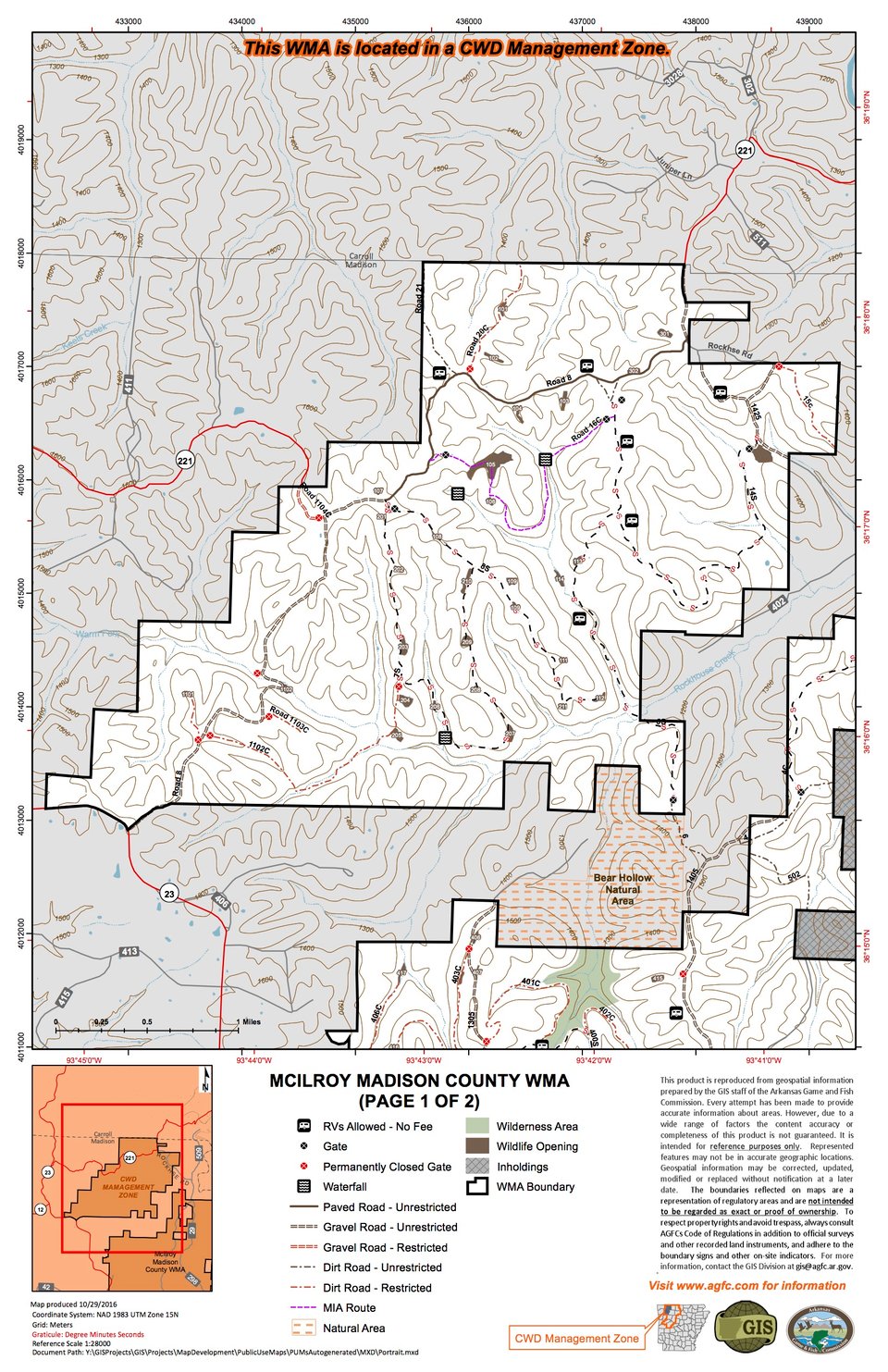
The area is typical rugged Ozark Mountain terrain with numerous steep mountains and hollows. Elevations range from 1100 to over 1600 feet above mean sea level. The area is extensively forested in upland hardwood and shortleaf pine/upland hardwood timber stands with associated understory and midstory vegetation. There are numerous small streams on the area that are all tributaries of the nearby King’s River which skirts the eastern boundary of the area. The area consists of a total of 14,536 acres of state owned land.
Major access to area is from state highway 23. To find the area from Huntsville take highway 23 north approximately 12 miles or from Eureka Springs south about 13 miles. Highway directional signs indicate access roads from Highway 23 to the interior of the area. Except for one small tract the area lies east of Highway 23.
The area provides good public hunting opportunities for white-tailed deer, wild turkeys, squirrels and raccoons. Modern gun and muzzleloader deer hunting has been by permit only in recent years in order to maintain hunting pressure and the corresponding deer harvest at desirable levels. Hunters wishing to apply for firearms deer hunting permits should contact an Arkansas Game and Fish Commission office in early May of each year to obtain information or an application for the permit hunt drawings. Archery deer hunting, wild turkey and small game hunting only require the appropriate hunting license at this time. Hunters should always refer to a current edition of the Arkansas Hunting Regulations Guide prior to hunting on any wildlife management area. Hunting seasons and regulations may be changed from year to year for management purposes.