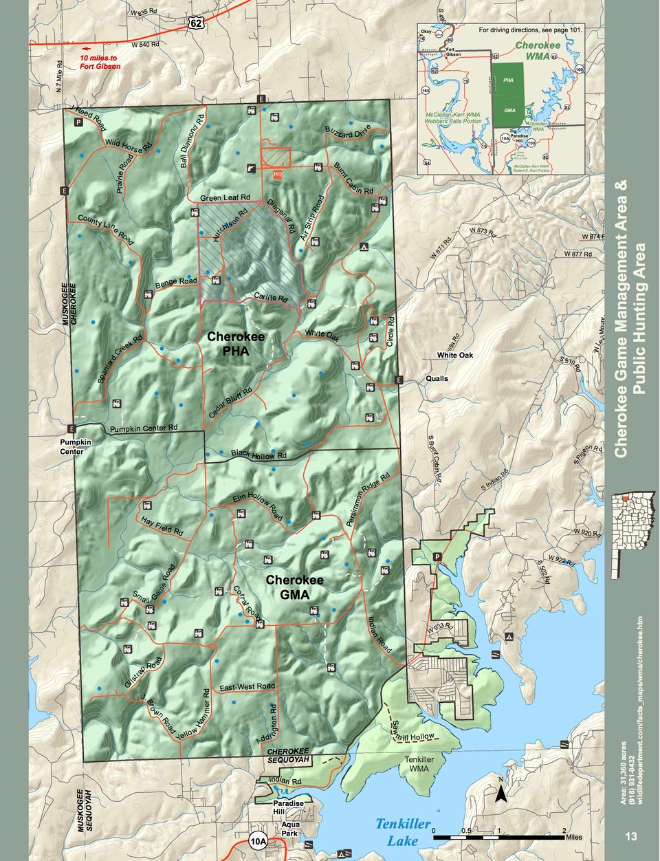
Cherokee WMA consists of approximately 31,360 acres in southwestern Cherokee County and is located two miles south of Hwy. 62 at Zeb, Oklahoma.
The WMA is a mixture of uplands with scattered fields and small stream riparian areas. Numerous ponds dot the landscape. Oak-hickory timber on rolling hills predominate the area. Fields and meadows with native bunch grasses and brushy thickets are found throughout with several seasonal small streams bisecting the area. The main drainage is Greenleaf Creek, which runs east to west, and contains typical bottom land over-story such as: sycamore, elm, ash, hackberry, mulberry and pecan. The average annual precipitation is about 41 inches.
The management area is divided into a 16,000-acre Public Hunting Area (PHA) and a 15,360-acre Game Management Area (GMA). The PHA is generally open year around for legal seasons, while the GMA is open mainly for controlled hunts. Consult regulations for area use restrictions.
Driving Directions: From Ft. Gibson: 10 miles east on U.S. Hwy 62, turn south at the Midway gas station (S460), two miles to the Zeb entrance to area.