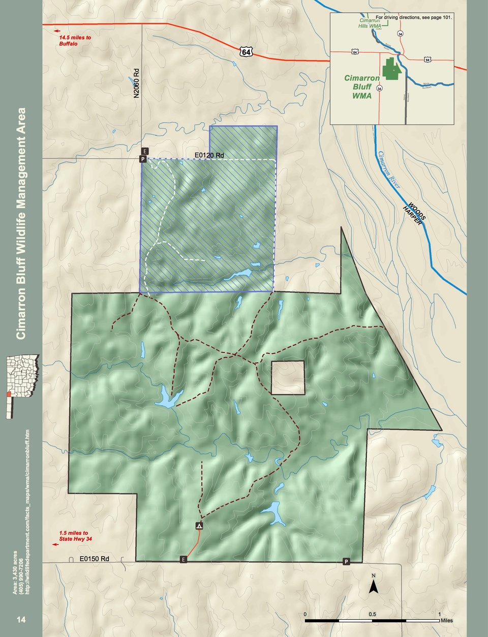
Cimarron Bluff WMA covers 3,430 acres in northeastern Harper County. Located north of the city of Woodward. It is four miles south of the junction of Highways 34 and US 64 and than one and a half mile east on County Road 15 (it may not be labeled) to the one of the parking areas. Cimarron Bluff WMA is primarily rolling hills with high bluffs overlooking the west side of the Cimarron River. Area is dominated by mixed-grass prairie vegetation with isolated pockets of sand sagebrush, sand plum, and sumac occurring on red clay and gypsum soils. Cottonwood, hackberry, and western soapberry trees exist along the creeks flowing through the property. A limited amount of Cimarron River flood plain exists along the east boundary of the WMA, dominated by salt flats, interspersed with salt cedar.
Driving Directions:
North entrance – From Buffalo: 16 miles east on U.S. Hwy 64, 1 mile south on N2060 (which is 1 mile east of State Hwy 34).
South entrance – From Buffalo: 15 miles east on U.S. Hwy 64, 4 miles south on State Hwy 34, 1½ miles east on Harper County Rd 15 (E0150).