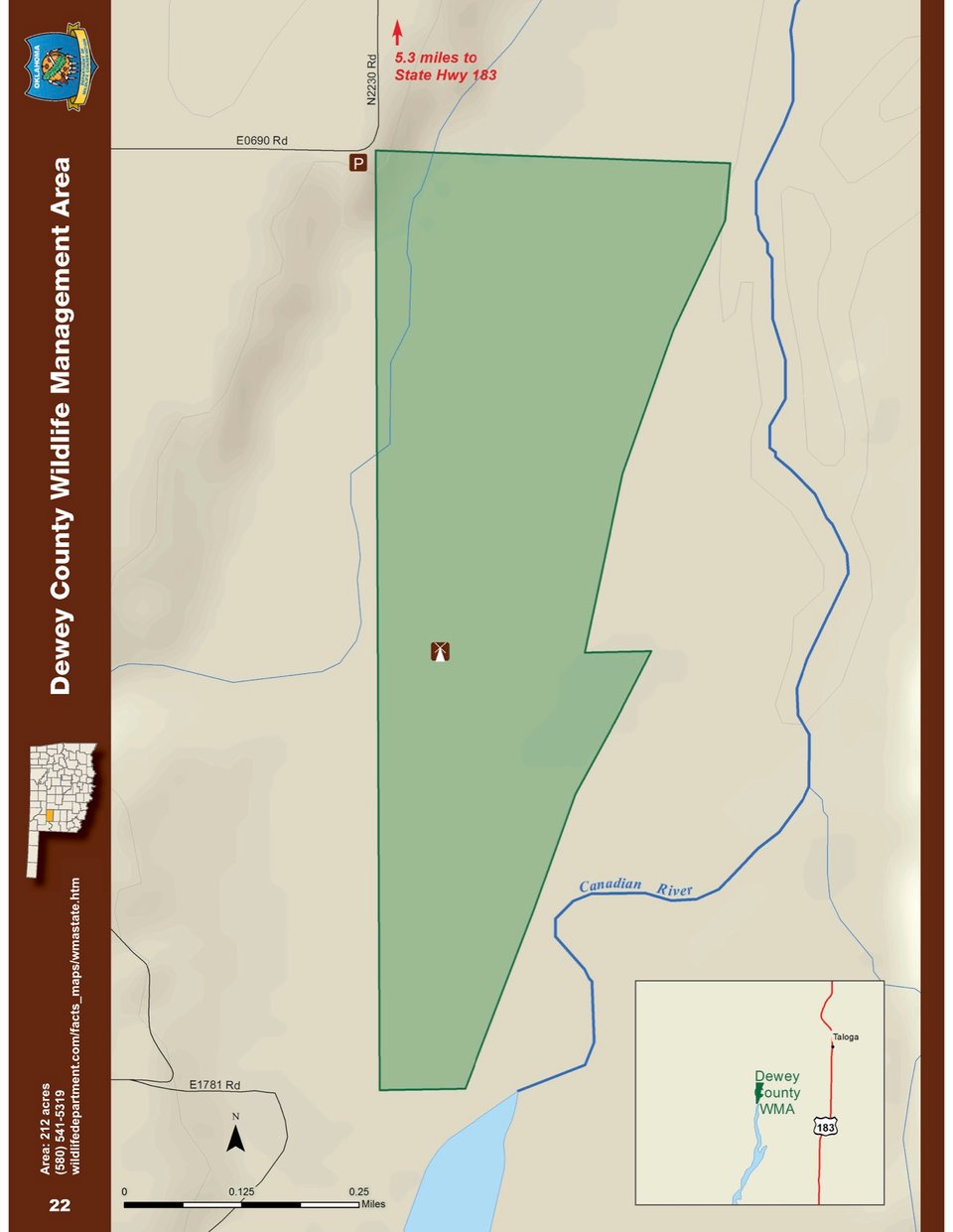
Dewey County WMA covers 212 acres in Dewey County in northwest Oklahoma. Located approximately 4 miles west of Taloga, this tract is western Oklahoma bottomland habitat and lays adjacent to the Canadian River. Habitat consists of a cottonwood/elm overstory with Eastern red cedar understory and sandplum in open areas. Water resources are provided by the Canadian River and intermittent springs. One windmill and overflow pond is also available. Annual precipitation for the area is approximately 27 inches. Driving directions to this WMA are: from Taloga, Oklahoma; one mile north on State Highway 183, 3.8 miles west on a county blacktop road, 1.5 miles south on a gravel/dirt road. Access to Dewey County WMA is foot access only from a parking area at the northwest corner of the WMA. Hip waders may be necessary to access the WMA during wet periods.
Driving Directions: From Taloga: 1 mile north on State Hwy 183, 3.8 miles west on county blacktop road (E0665, to N2240, to E0670), 1½ miles south on N2230 to parking area.