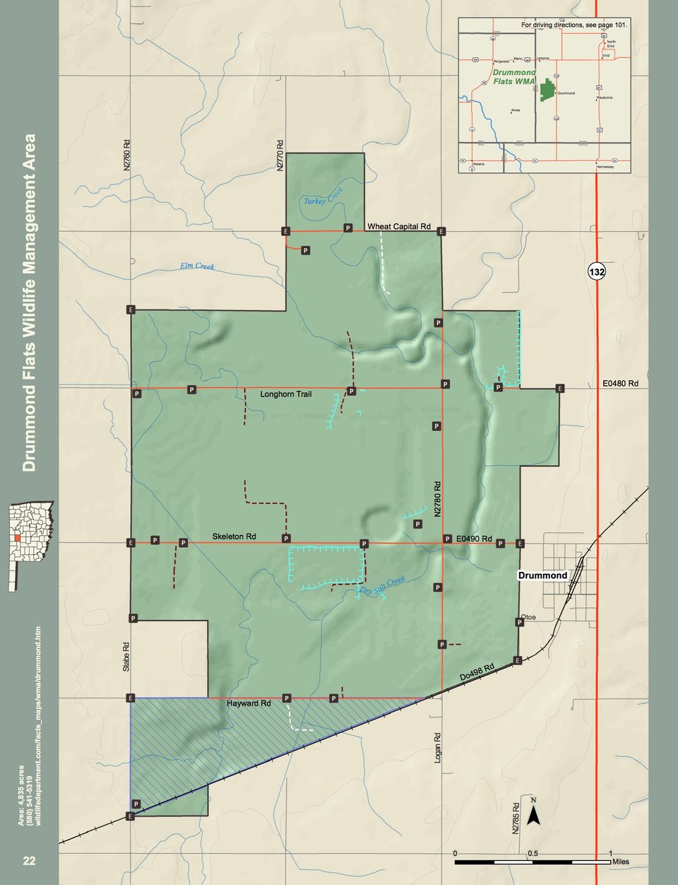
Drummond Flats WMA covers 4,653 acres in western Garfield county in north central Oklahoma. Located immediately west of the town of Drummond, or approximately 8 miles southwest of Enid, Drummond Flats is a historic overflow basin at the confluence of Turkey Creek, Elm Creek, and Salt Creek, and is predominately wetland habitat with some surrounding upland habitat.
The average annual precipitation for the area is about 34 inches.
Driving Directions: From Drummond: ½ mile west of the junction of State Hwy 132 and Skeleton Rd.