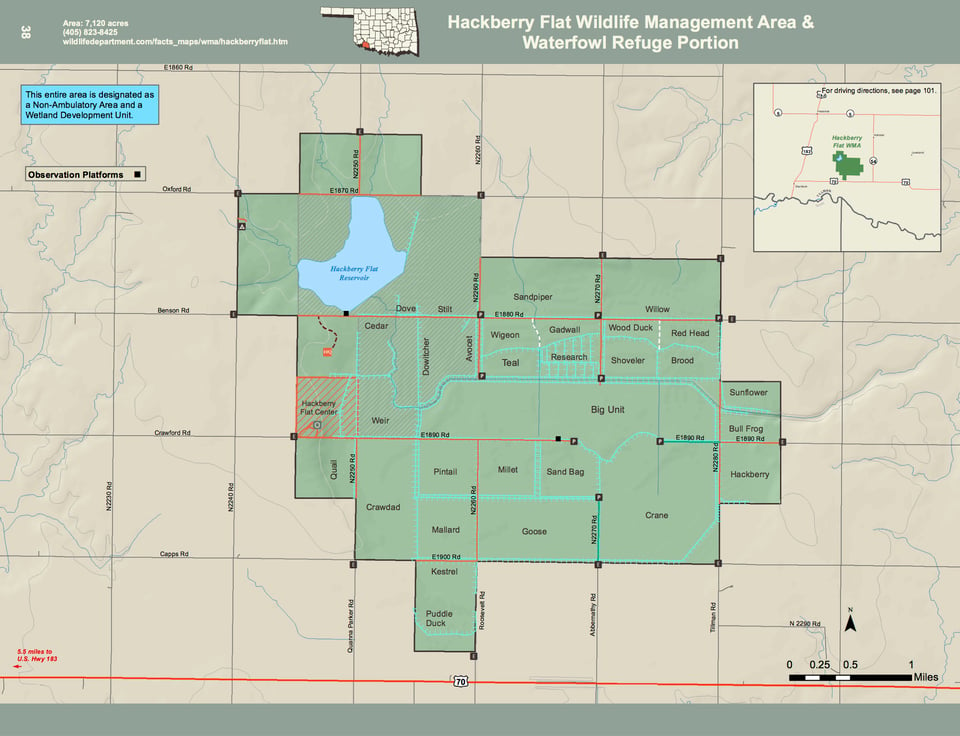
Hackberry Flat WMA covers 7,120 acres of southwestern Tillman County in Western Oklahoma. Located southeast of the town of Frederick, Hackberry Flat WMA is a combination of upland and wetland habitats.
The 3,700 acre wetland development unit consists of a variety of plants such as millet, sedges, and smartweed, and some agriculture fields. Uplands consist of agriculture fields, native grasses, improved grasses, and forbs, interspersed with mesquite, hackberry, Osage orange, black locust, and sand plum. The average annual precipitation for the area is approximately 27 inches.
Most water in wetland units comes from rainfall runoff. Rainfall amounts in this region greatly fluctuate between years; therefore, the number of wetland units flooded at any given time is highly variable.
WMA Driving Directions: From Frederick: 1 mile South on U.S. Hwy 183, 3 miles east on E1830, 5 miles south on N2240, east on Benson Rd (E1880) into area. Or, continue another mile south on N2240, east on Crawford Rd (E1890) to Center.