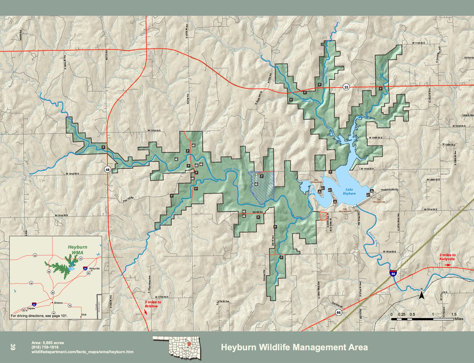
The Heyburn WMA is a 5,865 acre tract of US Army COE land surrounding Heyburn Lake. It has numerous post oak-blackjack ridges and old abandoned agricultural fields. It is located south of Hwy. 33, east of Hwy. 48, and north of Hwy. 66, in central Creek County.
Oaks, elms and sycamores dominate the woodland canopy, with native grass meadows in woodland openings. Due to its varied soils and vegetation types, the area supports a diversity of native and migratory wildlife. Heyburn Lake is a small COE flood control and water supply reservoir that is now very shallow in its upper reaches and no longer navigable by large boats. The average annual precipitation is 42 inches.
WMA Driving Directions: From Bristow: 12 miles north on State Hwy 48, 3 miles east on State Hwy 33, 2 miles south on S. 305th Ave W (access road to COE Sheppard Point Park).