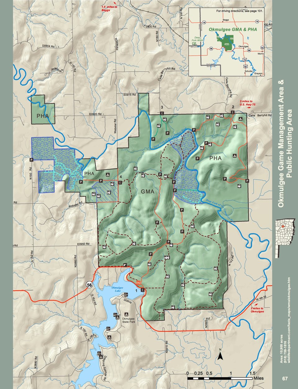
Okmulgee Wildlife Management Area covers 10,900 acres of west-central Okmulgee County. Located 5 miles west of the city of Okmulgee, the area is heavily wooded in post oak-blackjack timber and bisected by seven miles of the Deep Fork of the Canadian River. The Okmulgee Wildlife Management Area contains one of the largest known tracts of old growth Post oak/Blackjack oak "Crosstimbers" found anywhere. Many of the area's post oaks are likely over 350 years old, making them some of the oldest trees found East of the Rocky Mountains in North America. Crosstimber, although not highly productive, is unique in that it provides habitat for both classic "Western" species like the Greater Roadrunners and Easter species like the Indigo Bunting and is rich in biological diversity.
The area is approximately 95% wooded, with elevations ranging from about 600 ft. near the river to over 950 ft. on wooded ridges. Post oaks, blackjack oaks, and hickories dominate the poor, rocky upland soils, with burr oaks, pin oaks, red oaks and sycamores dominating the riparian bottomland. The average annual rainfall is 42 inches.
WMA Driving Direction:
Entrance #1 – From Okmulgee: From U.S. Hwy 75, 6.9 miles west on State Hwy 56 to entrance on right.
Shooting Range – From Okmulgee: From U.S. Hwy 75, 7.9 miles west on State Hwy 56 to entrance on right.
Entrance #2 – From Okmulgee: From State Hwy 56, 4 miles north on U.S. Hwy 75, 3 miles west on Celia Berryhill Road to entrance on left.
Entrance #3 – From Okmulgee: From State Hwy 56, 4 miles north on U.S. Hwy 75, 5 miles west on Celia Berryhill Road (always keep left) to entrance on left.
Entrance #4 – From Beggs: 1.4 miles south on U.S. Hwy 75 ALT, right on Webster Rd, 4.2 miles south on Webster Rd to entrance on right