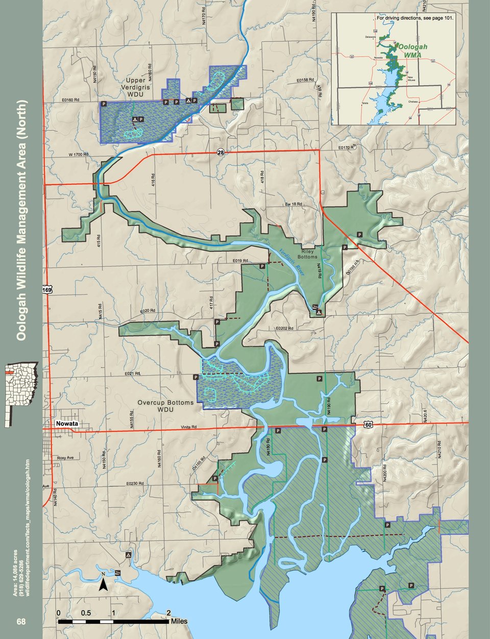
Oologah WMA covers 12,941 acres in Nowata and Rogers counties in northeastern Oklahoma Located just east of Hwy. 169, southeast of the town of Nowata, Oak, pecan and willow are the predominant tree species present in the river bottoms. Locust, button bush, willow, hackberry and elm are present around the lake with some old fields and native grass interspersed throughout. The average annual precipitation for the area is about 39 inches.
WMA Driving Directions and places of interests:
Goose Island – From Oologah: 4 miles north on U.S. Hwy 169, 4.5 miles east on EW road 35 (E0350).
Overcup Bottoms WDU – From Nowata: 2 miles east on State Hwy 60, 1 mile north on NS road 416 (N4160), and 1 mile east on EW road 21 (E0210).
Upper Verdigris River – From Delaware: 1 mile north on U.S. Hwy 169, 2 miles east on EW road 15 (E0150), 1 mile south on NS road 416 (N4160).
Riley Bottoms area along Verdigris River – From Nowata: 3 miles north on U.S. Hwy 169, and 3½
miles east on EW road 19 (E0190).
Salt Creek area on Oologah Lake – From Nowata: 8 miles east on U.S. Hwy 60, 3 miles south on State Hwy 28, 1¼ miles west on EW road 25 (E0250).
Lightning Creek area on Oologah Lake – From Nowata: 8 miles east on U.S. Hwy 60, 3 miles
south on State Hwy 28, 1 mile west on EW road 25 (E0250), 1 mile south on NS road 421 (N4210).
Panther Creek area on Oologah Lake – From Nowata: 8 miles east on U.S. Hwy 60, 3 miles
south on State Hwy 28, 1 mile west on EW road 25 (E0250), 2 miles south on NS road 421 (N4210), ½ mile west on EW road 27 (E0270).
Winganon area – From Winganon: The WMA runs north and south of the town.
Spencer Creek area – From Chelsea: 5 miles west on EW road 32 (E0320, part of which is State Hwy 28), 2 miles south on NS road 420 (N4200).
Cherokee Central area – From Chelsea: 6 miles west on EW road 32 (E0320, part of which is State Hwy 28), 2 miles south on NS road 419 (N4190)