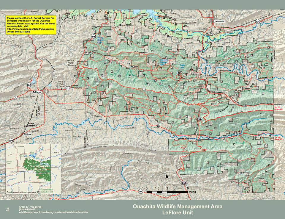
Ouachita WMA covers 225,000 acres of the Ouachita National Forest Lands in southeastern Oklahoma. The area is managed cooperatively between the Oklahoma Department of Wildlife Conservation and the United States Forest Service. The area is located in southern Leflore county approximately 10 miles south of Heavener, Ok. on Highway 59. Located in the scenic, mountainous, oak-pine forest, the area’s primary species is deer and turkey, more than 400 acres of food plots are planted annually for these species.
The Talimena Scenic Drive cuts the area in half running along the top of Winding Stair Mountain from Highway 271 to the Arkansas line. This drive offers many scenic vistas to pull off and enjoy the view. Some camping is available along the drive and at the Cedar Lake Camp ground.
WMA Driving Directions:
WMA Headquarters – From Heavener: 7 miles south on U.S. Hwy 59, 0.1 mile east on Fish Hatchery Rd, first building on right side of road.
U.S. Forest Service Visitor Center – From Heavener: 10 miles south on U.S. Hwy 59. (3 miles south of WMA Headquarters.)
U.S. Forest Service Visitor Center – From Talihina: 3 miles north on U.S. Hwy 271.
U.S. Forest Service Visitor Center (open seasonally) – From Talihina: 8 miles north on U.S. Hwy 271, turn east on Talimena Dr (State Hwy 1).
From Broken Bow: 40 miles north on U.S. Hwy 259, look for USFS/Ouachita WMA boundary signs.
From Mena, AR: 15 miles west on AR State Hwy 8, turns into OK State Hwy 63, look for USFS/Ouachita WMA boundary sign.
From Acorn, AR: 13 miles west on U.S. Hwy 270 to OK state line, look for USFS/Ouachita WMA
boundary sign.
From Queen Wilhelmina State Park, AR: 4 miles west on AR State Hwy 88, turns into OK State Hwy 1, look for USFS/Ouachita WMA boundary sign.