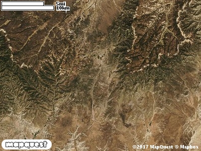
Except for about 750 hectares around the town of Alton, Utah; the Alton Cooperative Wildlife Management Unit (CWMU) surrounds the
town. To the northeast of Alton (7500 feet), mountains rise from 8500 to 9000 feet. These mountains slope down toward the Sevier River at an elevation of around 7200 feet on the north. On the the south, these mountains slope down to the Kanab River which parts the Alton CWMU on the southeast. The most common elevation is 7400 feet but ranges from 6400 feet to 9000 feet with an elevation difference of 2600 feet. Fifty-two percent (52%) of the CWMU elevation ranges between 7300 feet and 8200 feet an elevation difference of 900 feet.Lower elevations on the Unit are around 6800 feet. Towards the southwest of the Alton Cooperative Wildlife Management Unit (CWM), there are extensive areas of Colorado Plateau Pinyon-Juniper Woodland (36). A co-dominant land cover type is Rocky Mountain Gambel Oak-Mixed Montane Shrubland (41). This Shrubland occurs throughout the Unit except for the extreme north. In the extreme north and towards the middle
of the Unit are large areas of Inter-Mountain Basins Montane Sagebrush Steppe (62). There are also large patches of Inter-Mountain Basins Big Sagebrush Shrubland (48). The Alton
CWMU also has large patches of Rocky Mountain Ponderosa Pine Woodland (34) and Agriculture (114) is scattered throughout the Unit.
One of the Alton Cooperative Wildlife Mangement Unit (CWMU) nearest weather stations, ALTON (420086), is about 1.0 km from the middle of the CWMU. ALTON has eighty-three (83) years of records, 1915 - 2008. During the FALL (September, October and November) the average precipitation is 4.14 inches, but it can be as high as 11.35 inches or as low as 0.36 inch. During the 91-day FALL period, 14 days will experience greater than or equal to 0.01 inch of precipitation, 9 days of greater than or equal to 0.10 inch, or 3 days of the greater than or equal to 0.50 inch of precipitation. There can also be 1 day of greater than or equal to 1.00 inch of perciptiation. Total FALL snowfall averages 7.6 inches but can be as high as 41.7 inches. FALL temperature at ALTON averages 47.3 degrees F. but can be as high as 91.0 degrees F. or as low as -5.0 degrees F. During the FALL, 44 days will be below freezing (32 degrees F.) and less than 1 day above 90 degrees F.