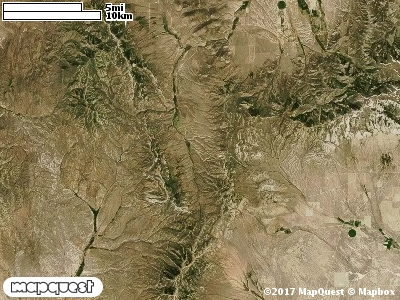
The Dove Creek Cooperative Wildlife Management Unit (CWMU) is located south of Junction Valley which forms the junction between the Grouse Creek Mountains on west and the Raft River Mountains on the north-northeast. Much of the Unit is located on what is called the Dove Creek Mountains. Marble Canyon Peak at about 8300 feet is the high point of the Unit. This peak is on the west side of the Unit. It drops away to 6400 feet on the north and 6000 feet on the south. While the west side of the Unit is
mountainous terrain, the east side is much flatter, 5900 feet in the north and 5600 feet in the south from the Geologic effects of the ancient Lake Bonneville. Starting in the north there are
several canyons that cut the unit, Road Canyon (7300 feet to 6000 feet), Marble Canyon (8000 feet to 7200 feet), Poison Canyon (7500 feet to 6000 feet), and Muddy Canyon (7500 feet to 5800 feet). The most common elevation is 5900 feet but ranges from 5600 feet to 8300 feet with an elevation difference of 2700 feet. Fifty percent (50%) of the CWMU elevation ranges between 6300 feet and 7600 feet an elevation difference of 1300 feet.On the northwest half of the Dove Creek Cooperative Wildlife Management Unit (CWMU), the
Unit is dominated by Inter-Mountain Basins Montane Sagebrush Steppe (62). On the southeast half the Unit is dominated by a mixture of Inter-Mountain Basins Big Sagebrush Shrubland (48) and Great Basin Pinyon-Juniper Woodland (37). Scattered throughout the Unit, but mostly in the middle are patches of Great Basin Xeric Mixed Sagebrush Shrubland (49) and Inter-Mountain Basins Cliff and Canyon (8).One of the Dove Creek Cooperative Wildlife Mangement Unit (CWMU) nearest weather stations, GROUSE CREEK (423486), is about 12.9 km southwest from the southwest edge of the CWMU. GROUSE CREEK has forty-nine (49) years of records, 1959 - 2008. During the FALL (September, October and November) the average precipitation is 2.25 inches, but it can be as high as 4.42 inches or as low as 0.60 inch. During the 91-day FALL period, 16 days will experience greater than or equal to 0.01 inch of precipitation, 7 days of greater than or equal to 0.10 inch, or 1 day of the greater than or equal to 0.50 inch of precipitation. Snowfall during the FALL averages 3.6 inches but can be as high as 21.0 inches. FALL temperature at GROUSE CREEK averages 46.0 degrees F. but can be as high as 97.0 degrees F. or as low as -12.0 degrees F. During the FALL, 54 days will be below freezing (32 degrees F.) and 1 day above 90 degrees F.