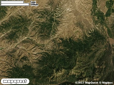
The East Fork Chalk Cooperative Wildlife Management Unit (CWMU) is east of Coalville, Utah up Chalk Creek. Humpy Peak at greater than 10,800 feet is the high point of the Unit. The elevation along the East Fork of Chalk Creek decreases to 6700 feet. Both the East Fork and Middle Fork of Chalk Creek are part of the unit. The East Fork decreases from 9600 feet and the Middle Fork from 7700 feet to where the combine at 7200 feet. Except for the abrupt extension of Humpy Peak the relief on the eastside of the Unit is not as steep as that on the west side. The most common elevation is 9700 feet but ranges from 6700 feet to 10800 feet with an elevation difference of 4100 feet. Fifty-three percent (53%) of the CWMU elevation ranges between 7800 feet and 9700 feet an elevation difference of 1900 feet.
The East Fork Chalk Creek Cooperative Wildlife Management Unit (CWMU) land cover is a combination of Rocky Mountain Aspen Forest and Woodland (22) and Inter-Mountain Basins Montane Sagebrush Steppe (62). The Aspen Forest and Woodland is in the middle of the
unit. The Sagebrush Steppe is scattered from the northwest through the middle and into the the southeast part of the Unit. Rocky Mountain Gambel Oak-Mixed Montane Shrubland (41)and Rocky Mountain Subalpine Dry-Mesic Spruce-Fir Forest and Woodland (26) also add
to the land cover on certain parts of the Unit.One of the East Fork Chalk Creek Cooperative Wildlife Mangement Unit (CWMU) nearest weather stations, COALVILLE (421590), is about 3.0 km west from the west edge of the CWMU. COALVILLE has thirty-four (34) years of records, 1974 - 2008. During the FALL (September, October and November) the average precipitation is 3.71 inches, but it can be as high as 7.09 inches or as low as 1.68 inches. During the 91-day FALL period, 19 days will experience greater than or equal to 0.01 inch of precipitation, 10 days of greater than or equal to 0.10 inch, or 2 day of the greater than or equal to 0.50 inch of precipitation. Snowfall during the FALL averages 14.8 inches but can be as high as 32.0 inches. FALL temperature at COALVILLE averages 43.4 degrees F. but can be as high as 87.0 degrees F. or as low as -17.0 degrees F. During the FALL, 61 days will be below freezing (32 degrees F.) and no days above 90 degrees F.