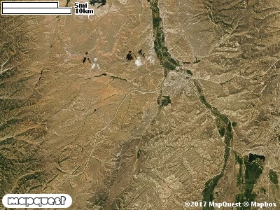
The Ensign Ranches Cooperative Wildlife Management Unit (CWMU) is up Echo Canyon on both sides of Interstate Highway I-80. The highest point on the Unit is in the southeast at 9200 feet. This drops down to 5900 feet in Echo Canyon. On the other side of I-80 the elevation ranges from 7600 feet to 5900 feet. To the north elevation is around 6800 feet, to the east 7300 feet, to the south 6400 feet, and to the west 7600 feet. There are relatively flat areas in the southeast (7600 feet) with many waterbodies. The terrain on the north side of I-80 is steeper than on the south side. The most common elevation is 6900 feet but ranges from 5900 feet to 9100 feet with an elevation difference of 3200 feet. Fifty-five percent (55%) of the CWMU elevation ranges between 6900 feet and 8100 feet an elevation difference of 1200 feet.Over fifty percent (50%) of the land cover on the Ensign Ranches Cooperative Wildlife Management Unit (CWMU) is Inter-Mountain Basins Montane Sagebrush Steppe (62). Towards the southwest are areas of Rocky Mountain Gambel Oak-Mixed Montane Shrubland (41). Towards the southeast and some in the northwest area areas of Rocky Mountain Aspen Forest and Woodland (22). There are areas of Colorado Plateau Pinyon-Juniper Woodland (36), and in the north patches of Southern Rocky Mountain Montane-Subalpine Grassland (71). Inter-Mountain Basins Big Sagebrush Steppe (66) adds to the Shrub-Steppe component, and there are large patches of Recently Burned (116) areas.One of the Ensign Ranches Cooperative Wildlife Mangement Unit (CWMU) nearest weather stations, COALVILLE (421590), is about 5.4 km south from the south edge of the CWMU. COALVILLE has thirty-four (34) years of records, 1974 - 2008. During the FALL (September, October and November) the average precipitation is 3.71 inches, but it can be as high as 7.09 inches or as low as 1.68 inches. During the 91-day FALL period, 19 days will experience greater than or equal to 0.01 inch of precipitation, 10 days of greater than or equal to 0.10 inch, or 2 day of the greater than or equal to 0.50 inch of precipitation. Snowfall during the FALL averages 14.8 inches but can be as high as 32.0 inches. FALL temperature at COALVILLE averages 43.4 degrees F. but can be as high as 87.0 degrees F. or as low as -17.0 degrees F. During the FALL, 61 days will be below freezing (32 degrees F.) and no days above 90 degrees F.