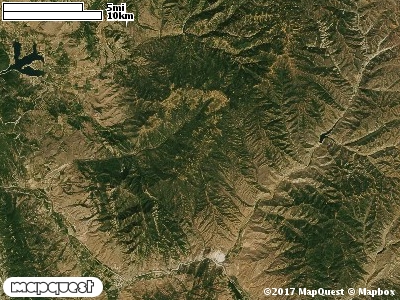
The Folley Ridge Cooperative Wildlife Management Unit (CWMU) is northwest of Croydon, Utah. This CWMU is in two distinct areas.
The south area follows the Folley Ridge which ranges between 7000 feet in the south to 8300 feet in the north. The north border of the south area is around 8100 feet, to the east about 7200 feet, to the south 5400 feet and to the west 6800 feet. The north area is northeast of the south area. The north area highest point is Guilder Peak at around 8300 feet. To the north the area is 8100 feet, to the east 8000 feet, to the south also 8000 feet, and to the west 8300 feet like Guilder Peak. The most common elevation is 8200 feet but ranges from 5400 feet to 8400 feet with an elevation difference of 3000 feet. Fifty-two percent (52%) of the CWMU elevation ranges between 6100 feet and 7700 feet an elevation difference of 1600 feet.
Most of the Folley Ridge Cooperative Wildlife Management Unit (CWMU) is covered by Inter-Mountain Basins Montane Sagebrush Steppe (62). The next most common land cover type is Rocky Mountain Aspen Forest and Woodland (22). This Forest and Woodland is more
prominent on the north section of the Unit. Another prominent land cover type particularly on the south section is Rocky Mountain Gambel Oak-Mixed Montane Shrubland (41). Although in a minor role Rocky Mountain Bigtooth Maple Ravine Woodland (23) is present on both the north and south sections.
One of the Folley Ridge Cooperative Wildlife Mangement Unit (CWMU) nearest weather stations, MORGAN (425826), is about 9.8 km southwest from the southwest edge of the CWMU. MORGAN has one hundred five (105) years of records, 1903 - 2008. During the FALL (September, October and November) the average precipitation is 3.80 inches, but it can be as high as 7.28 inches or as low as 0.46 inch. During the 91-day FALL period, 18 days will experience greater than or equal to 0.01 inch of precipitation, 11 days of greater than or equal to 0.10 inch, or 2 day of the greater than or equal to 0.50 inch of precipitation. Snowfall during the FALL averages 7.3 inches but can be as high as 25.3 inches. FALL temperature at MORGAN averages 46.9 degrees F. but can be as high as 98.0 degrees F. or as low as -12.0 degrees F. During the FALL, 53 days will be below freezing (32 degrees F.) and 1 day above 90 degrees F.