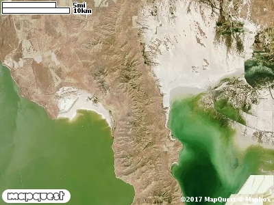
The Fort Ranch Cooperative Wildlife Management Unit (CWMU) is located on Promontory Point in the north Great Salt Lake. Messix Peak at 7400 feet is highest point on the Unit. The elevation from this point drops away to 5100 feet in the north and 6400 feet in the south. The elevation from this ridge decrease in the west to about 4200 feet, almost the shore of the Great Salt Lake. The general terrain is one of the sides of a large geologic bowl cut by a prominant drainage, Maple Canyon, 4300 feet to 5000 feet. The most common elevation is 6000 feet but ranges from 5700 feet to 9900 feet with an elevation difference of 4200 feet. Fifty-seven percent (57%) of the CWMU elevation ranges between 6600 feet and 9000 feet an elevation difference of 2400 feet.
A banding of Inter-Mountain Basins Big Sagebrush Shrubland (48) and Great Basin Pinyon-Juniper Woodland (37) account of over fifty percent of the land cover on the eastside of the Fort
Ranch Cooperative Wildlife Management Unit (CWMU). In the middle of the CWMU Invasive Annual and Biennial Forbland (122) and Invasive Annual Grassland (121) occupy most of the land cover. There area drier areas of Inter-Mountain Basins Greasewood Flat (82), Great Basin Xeric Mixed Sagebrush Shrubland (49), and Inter-Mountain Basins Playa (14) on the Unit.
One of the Fort Ranch Cooperative Wildlife Mangement Unit (CWMU) nearest weather stations, BEAR RIVER REFUGE(420506), is about 18.8 km west from the west edge of the CWMU. BEAR RIVER REFUGE has forty-seven (47) years of records, 1937 - 1984. During the FALL (September, October and November) the average precipitation is 3.50 inches, but it can be as high as 11.58 inches or as low as 1.09 inches. During the 91-day FALL period, 17 days will experience greater than or equal to 0.01 inch of precipitation, 9 days of greater than or equal to 0.10 inch, or 2 days of greater than or equal to 0.50 inch of precipitation. Snowfall during the FALL averages 1.7 inches but can be as high as 9.0 inches. FALL temperature at BEAR RIVER REFUGE averages 51.7 degrees F. but can be as high as 97.0 degrees F. or as low as -3.0 degrees F. During the FALL, 25 days will be below freezing (32 degrees F.) and 3 days above 90 degrees F.