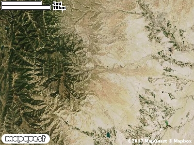
The Hiawatha Cooperative Wildlife Management Unit (CWMU) is southwest of Price, Utah. The town of Hiawatha is on the eastside of the Unit, and is part of the Unit. Maximum elevation ranges from 9800 feet in the northwest. It drops off to just 9700 feet in the north and follows Bald Ridge down in the south to 9400 feet.
The major drainage of the Unit is Miller Creek. The Right Fork of Miller Creek ranges from 9400 feet to 7000 feet, the Middle Fork, 8800 to 7000 feet, and the left fork, 8800 feet to 7000 feet.
On the south of Bald Ridge, Cedar Creek ranges from 9000 feet to 7400 feet. The most common elevation is 9300 feet but ranges from 7100 feet to 9900 feet with an elevation difference of 2800 feet. Fifty-five percent (55%) of the CWMU elevation ranges between 7800 feet and 9100 feet an elevation difference of 1300 feet.
About a quarter of the land area of the Hiawatha Cooperative Wildlife Management is Inter-Mountain Basins Montane Sagebrush Steppe (62), scattered throughout the unit. Another major
land type is Colorado Plateau Pinyon-Juniper Woodland (36), lined on the eastern side of the property. Then there is a set of six (6) forest and woodland types that give the unit its forest character, Rocky Mountain Aspen Forest and Woodland (22), Rocky Mountain Subalpine Dry-Mesic Spruce-Fir Forest and Woodland (26), Rocky Mountain Montane Mesic Mixed Conifer Forest and Woodland (32), Rocky Mountain Montane Dry-Mesic Mixed Conifer Forest and Woodland (30), Rocky Mountain Subalpine Mesic Spruce-Fir Forest and Woodland (28), and Inter-Mountain West Aspen-Mixed Conifer Forest and Woodland Complex (38).
One of the Hiawatha Cooperative Wildlife Mangement Unit (CWMU) nearest weather stations, HIAWATHA (423896), is on the east edge of the CWMU. HIAWATHA has seventy-six (76) years of records, 1916 - 1992. During the FALL (September, October and November) the average precipitation is 2.60 inches, but it can be as high as 3.20 inches or as low as 1.93 inches. During the 91-day FALL period, 12 days will experience greater than or equal to 0.01 inch of precipitation, 9 days of greater than or equal to 0.10 inch, or 1 day of the greater than or equal to 0.50 inch of precipitation. Snowfall during the FALL averages 1.4 inches but can be as high as 3.0 inches. FALL temperature at HIAWATHA averages 47.1 degrees F. but can be as high as 86.0 degrees F. or as low as 5.0 degrees F. During the FALL, 35 days will be below freezing (32 degrees F.) and no day above 90 degrees F.