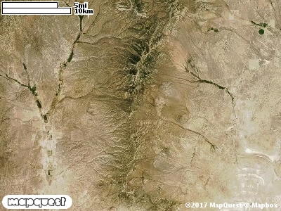
The Ingram Peak Cooperative Wildlife Management Unit (CWMU) is located on the eastside of the Grouse Creek Mountains. The higher
elevations are on the west border of the Unit. In the north these elevation start at 7600 feet, they
increase to 8500 feet, then back down to 8300 feet before climbing again to Ingram Peak at 8400
feet. In the south these elevations drop to around 7400 feet. Cottonwood Creek is a major west
to east drainage in the north. Cottonwood Creek starts at about 7400 feet and flows into Muddy
Creek exiting the Unit at around 5300 feet. Another major drainage is Birch Creek. It starts at
7900 feet elevation and exits the Unit at 5300 feet. Little Birch Creek is similar, beginning at
7500 feet and exiting at 5300 feet. The eastside of the Unit has much more relief that the westside. The most common elevation is 5400 feet but ranges from 5100 feet to 8500 feet with an elevation difference of 3400 feet. Forty-nine percent (49%) of the CWMU elevation ranges between 5700 feet and 7700 feet an elevation difference of 2000 feet.
The most dominate land cover type on the Ingham Peak Cooperative Wildlife Managemet Unit
(CWMU) is Inter-Mountain Basins Big Sagebrush Shrubland (48). This is followed by another
Sagebrush dominated land cover type, Inter-Mountain Basins Montane Sagebrush Steppe (62).
Great Basin Xeric Mixed Sagebrush Shrubland (49) also adds to the Sagebrush character of
the Unit. Great Basins Pinyon-Juniper (37), Agriculture (114), and Inter-Mountain Basins
Semi-Desert Grassland (76) adds patches at certain locations on the Unit.
One of the Ingham Peak Cooperative Wildlife Mangement Unit (CWMU) nearest weather stations, GROUSE CREEK
(423486), is about 11.2 km west from the west edge of the CWMU. GROUSE CREEK has forty-nine (49) years of records, 1959 - 2008. During the FALL (September, October and November) the average precipitation is 2.25 inches, but it can be as high as 4.42 inches or as low as 0.60 inches. During the 91-day FALL period, 16 days will experience greater than or equal to 0.01 inch of precipitation, 7 days of greater than or equal to 0.10 inch, or 1 day of the greater than or equal to 0.50 inch of precipitation. Snowfall during the FALL averages 3.6 inches but can be as high as 21.0 inches. FALL temperature at GROUSE CREEK averages 46.0 degrees F. but can be as high as 97.0 degrees F. or as low as -12.0 degrees F. During the FALL, 54 days will be below freezing (32 degrees F.) and 1 day above 90 degrees F.