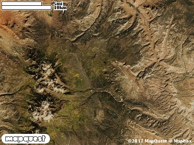
The J. B. Ranch Cooperative Wildlife Management Unit (CWMU) is located on the Colorado - Utah state line near the southeast corner
of Grand County and the northeast corner of San Juan County. The high point of the Unit is mid- to south at 8900 feet. From here it drops in elevation to the north and to the south. In the north John Brown Creek starts at 8800 feet and flows north exiting the Unit in the northwest corner at 7500 feet. John Brown Creek is also supported by Pace Lake at 8200 feet. In the south Rock Creek cuts the southwest corner ranging from 7400 feet to 7500 feet. Sally
Hollow also cuts the south part of the Unit ranging from 8100 feet to 8900 feet. The most common elevation is 8100 feet but ranges from 7400 feet to 9000 feet with an elevation difference of 1900 feet. Fifty-four percent (54%) of the CWMU elevation ranges between 7700 feet and 8400 feet an elevation difference of 700 feet.
Over half of the J. B. Ranch Cooperative Wildlife Management Unit (CWMU) is covered with Rocky Mountain Gambel Oak-Mixed Montane Shrubland (41), especially in the northern part of the unit. The other major land cover type contributor is Rocky Mountain Ponderosa Pine Woodland (34). There is a larger Pondersoa Pine Woodland patch in the south and this type is more scattered in the north.
One of the J B Ranch Cooperative Wildlife Mangement Unit (CWMU) nearest weather stations, LA SAL (424946), is 23.3 km southwest of the southwest edge of the CWMU. LA SAL has seventy-seven (77) years of records, 1901 - 1978. During the FALL (September, October and November) the average precipitation is 3.49 inches, but it can be as high as 8.90 inches or as low as 0.06 inch. During the 91 day FALL period, 12 days will experience greater than or equal to 0.01 inch of precipitation, 8 days of greater than or equal to 0.10 inch, or 2 days of the greater than or equal to 0.50 inch of precipitation. Snowfall during the FALL averages 6.8 inches but can be as high as 11.8 inches. FALL temperature at LA SAL averages 47.9 degrees F. but can be as high as 96.0 degrees F. or as low as -6.0 degrees F. During the FALL, 41 days will be below freezing (32 degrees F.) and no days above 90 degrees F.