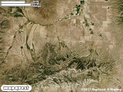
The Mountain Meadow Cooperative Wildlife Management Unit (CWMU) is on the border between Cassia County, Idaho and Box Elder County, Utah about 3 km west from Clear Creek, Utah on the Raft River Mountains. The Pinnacle reaches 8200 feet on the south boundary of the CWMU. The north boundary ranges from 5200 feet to 5800 feet. In the east, Water Canyon drains northeast and ranges between 5800 feet and 8000 feet. Near the middle of the unit Holt Creek drains north and ranges between 5000 feet and 7000 feet. Barnes Creek more to the westside of the unit ranges between 5800 feet and 6000 feet draining north. The most common elevation is 5900 feet but ranges from 5600 feet to 8600 feet with an elevation difference of 3000 feet. Fifty-three percent (53%) of the CWMU elevation ranges between 6300 feet and 7900 feet an elevation difference of 1600 feet.The Mountain Meadow Cooperative Wildlife Management Unit is covered (38%) with Inter-Mountain Basins Montane Sagebrush Steppe (62). Primarily located in the south two-thirds of the CWMU. Twenty-five percent (25%) of the CWMU is covered with Great Basin Pinyon-Juniper Woodland (37). This Pinyon-Juniper Woodland is mostly in the north. The only other land cover type that contributes much to the CWMU is Inter-Mountain Basins Cliff and Canyon (8), about 14%. This land cover type is more in the
southeast of the Unit.One of the Mountain Meadow Cooperative Wildlife Mangement Unit (CWMU) nearest weather stations, PARK VALLEY (427408), is about 16.5 km south from the south edge of the CWMU. PARK VALLEY has seventy-nine (79) years of records, 1911 - 1990. During the FALL (September, October and November) the average precipitation is 2.45 inches, but it can be as high as 6.38 inches or as low as 0.62 inch. During the 91-day FALL period, 13 days will experience greater than or equal to 0.01 inch of precipitation, 7 days of greater than or equal to 0.10 inch, or 1 days of the greater than or equal to 0.50 inch of precipitation. Snowfall during the FALL averages 5.8 inches but can be as high as 22.5 inches. FALL temperature at PARK VALLEY averages 48.4 degrees F. but can be as high as 93.0 degrees F. or as low as 0.0 degrees F. During the FALL, 36 days will be below freezing (32 degrees F.) and no days above 90 degrees F.