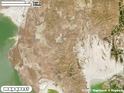
The North Promontory Cooperative Wildlife Management Unit (CWMU) is located on the north Promontory Mountains. The highest elevation are in the south at 7300 feet on Messix Peak. These high elevations decrease to 6500 feet in the north. Another high point is in the southwest corner of the Unit, Mt. Tarpey, about 7000 feet. Mt. Tarpey elevation decreases to Antelope Flat, 5300 feet. Most of the Unit extends from these higher elevation to the west where the boundary is about 4500 feet. Two drainages cut the Unit 0n the west side, South Cold Water, 4800 feet to 6300 feet and North Cold Water, 5000 feet to 6300 feet. On the eastside of the Promontory Mountains, North Canyon is the dominant drainage, 4900 feet to 5800 feet. The most common elevation is 4800 feet but ranges from 4300 feet to 7200 feet with an elevation difference of 2900 feet. Fifty-two percent (52%) of the CWMU elevation ranges between 5200 feet and 6200 feet an elevation difference of 1000 feet.Most of the higher elevation on the North Promontory Cooperative Wildlife Management Unit (CWMU) is Great Basin Pinyon-Juniper Woodland (37). Mixed among this Woodland and at lower elevations are large patches of Inter-Mountain Basins Big Sagebrush Shrubland (48). Towards the northwest among these Sagebrush Shrubland are large areas of Invasive Annual Grassland (122). Inter-Mountain Basins Semi-Desert Grassland (76), Great Basin Xeric Mixed Sagebrush Shrubland (49), and Invasive Annual and Biennial Forbland (122) also contribute
to the land cover of the Unit.One of the North Promontory Cooperative Wildlife Mangement Unit (CWMU) nearest weather stations, THIOKOL PLANT 78 (428668), is about 16.6 km northeast from the northeast edge of the CWMU. THIOKOL PLANT 78 has forty-five (45) years of records, 1962 - 2007. During the FALL (September, October and November) the average precipitation is 3.59 inches, but it can be as high as 8.85 inches or as low as 0.50 inch. During the 91-day FALL period, 18 days will experience greater than or equal to 0.01 inch of precipitation, 9 days of greater than or equal to 0.10 inch, or 2 days of the greater than or equal to 0.50 inch of precipitation. Snowfall during the FALL averages 2.8 inches but can be as high as 18.8 inches. FALL temperature at THIOKOL PLANT 78 averages 48.0 degrees F. but can be as high as 98.0 degrees F. or as low as -17.0 degrees F. During the FALL, 47 days will be below freezing (32 degrees F.) and 3 days above 90 degrees F.