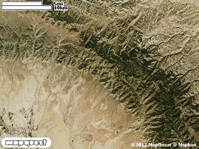
The Roan Cliffs Cooperative Wildlife Management Unit (CWMU) is north of Sunnyside, Utah and north, northwest, northeast and east of Grassy Trail Reservoir. In the northeast of the Unit, Mount Bartles is the highest point at 9900 feet. Also, there is a unnamed ridge running from the northwest to the southeast which starts at about 9400 feet in the north, reaches a maximum of about 9700 feet in the middle before decreasing to 8500 feet in the south. Whitmore Canyon, which ranges from 7800 feet to 8900 feet, cuts many parts of the Unit. Stone Cabin Draw, ranging from 7800 feet to 9000 feet, cuts the Unit in the extreme northeast. In the southwest part of the Unit, the Left Fork Whitmore Canyon cuts the Unit ranges from 8000 feet to 9100 feet. Bear Canyon also in the southwest of the Unit cuts the Unit ranging from 7300 feet to 8000 feet. The most common elevation is 8800 feet but ranges from 6600 feet to 9900 feet with an elevation difference of 3300 feet. Fifty-two percent (52%) of the CWMU elevation ranges between 6700 feet and 8400 feet an elevation difference of 1700 feet.Over forty percent (40%) of the Roan Cliffs Cooperative Wildlife Management Unit (CWMU) is Rocky Mountain Aspen Forest and Woodland (22). Scattered among the Aspen Forest and Woodland are patches of Inter-Mountain Basins Montane Sagebrush Steppe (62). To a lesser extent there are also patches of Inter-Mountain West Aspen-Mixed Conifer Forest and Woodland Complex (38). In the south half there are areas of Rocky Mountain Gambel Oak-Mixed Montane Shrubland (41) and Rocky Mountain Montane Dry-Mesic Mixed Conifer Forest and Woodland (30). Mostly in the north half are areas of Rocky Mountain Sualpine Dry-Mesic Spruce-Fir Forest and Woodland (26) and Rocky Mountain Subalpine Mesic Spruce-fir Forest and Woodland (28).One of the Roan Cliffs Cooperative Wildlife Mangement Unit (CWMU) nearest weather stations, SUNNYSIDE (428474), is 0.5 km east of the east edge of the CWMU. SUNNYSIDE has eighty-three (83) years of records, 1905 - 1988. During the FALL (September, October and November) the average precipitation is 4.13 inches, but it can be as high as 7.39 inches or as low as 1.66 inches. During the 91-day FALL period, 14 days will experience greater than or equal to 0.01 inch of precipitation, 9 days of greater than or equal to 0.10 inch, or 2 days of the greater than or equal to 0.50 inch of precipitation. There can also be 1 day with precipitation greater than or equal to 1.00 inch. Snowfall during the FALL averages 12.6 inches but can be as high as 31.0 inches. Fall temperature at SUNNYSIDE averages 49.2 degrees F. but can be as high as 89.0 degrees F. or as low as 8.0 degrees F. During the FALL, 30 days will be below freezing (32 degrees F.) and no day above 90 degrees F.