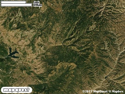
The Skull Crack Cooperative Wildlife Management Unit (CWMU) is south of Causey Reservoir. Part of the Weber - Morgan County line forms the boundary of this Unit in the southeast, the Unit overlaps this boundary in the south. Highest elevation is the west is 7700 feet elevation, rising to 8200 feet in the middle of the Unit, then dropping again to 8000 feet elevation. Many small drainages drop off to the north and west. The Pete Nelson Hollow, ranging from 6400 feet to 8000 feet is one of these drainages. Skull Crack (5800 feet to 8000 feet), Mill Hollow (5800 feet to 8000 feet), Mill Canyon (5600 feet to 7300 feet), Magpie Canyon (5400 feet to 7800 feet), Quarry Hollow (5300 feet to 6600 feet), and Sheep Herd Creek (5700 feet to 8000 feet) are other small drainages on the Unit. The most common elevation is 8100 feet but ranges from 5100 feet to 8200 feet with an elevation difference of 3100 feet. Forty-nine percent (49%) of the CWMU elevation ranges between 6000 feet and 7400 feet an elevation difference of 1400 feet.The Skull Crack Cooperative Wildlife Management Unit (CWMU) has a mixture of two (2) land cover types with strong contribution from a third. Rocky Mountain Aspen Forest and Woodland (22) is the most common, but Inter-Mountain Basins Montane Sagebrsuh Steppe (62) is almost as common. Rocky Mountain Gambel Oak-Mixed Montane Shrubland (41) is
also very common. Another common type is Rocky Mountain Bigtooth Maple Ravine Woodland (23). Rocky Mountain Montane Mesic Mixed Conifer Forest and Woodland (32) and Rocky Mountain Montane Dry-Mesic Mixed Conifer Forest and Woodland (30) contribute minor amounts to the Forest and Woodland character of the unit.
One of the Skull Crack Cooperative Wildlife Mangement Unit (CWMU) nearest weather stations, HUNTSVILLE MONESTERY (424135), is about 1.3 km west from the west edge of the CWMU. HUNTSVILLE MONESTERY has thirty-one (31) years of records, 1976 - 2007. During the FALL (September, October and November) the average precipitation is 5.74 inches, but it can be as high as 12.30 inches or as low as 1.36 inches. During the 91-day FALL period, 22 days will experience greater than or equal to 0.01 inch of precipitation, 14 days of greater than or equal to 0.10 inch, or 3 days of the greater than or equal to 0.50 inch of precipitation. There can also be 1 day of greater than or equal to 1.00 inch precipitation. Total FALL snowfall averages 10.2 inches but can be as high as 31.0 inches. FALL temperature at HUNTSVILLE MONESTERY averages 46.0 degrees F. but can be as high as 95.0 degrees F. or as low as -16.0 degrees F. During the FALL, 56 days will be below freezing (32 degrees F.) and less than 1 day above 90 degrees F.