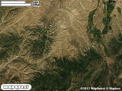
The State Corner Cooperative Wildlife Management Unit (CWMU) is located south of the notch where Utah and Wyoming share a common boundary. The highest elevation on the Unit is in the south, Humpy Peak at 10800 feet elevation. Lower elevations, 7100 feet are in the north. Chalk Creek or the a road running next to the creek form part of the Unit's boundary on the northwest, north and northeast. The elevation range on the CWMU for Chalk Creek is between 6700 feet and 7200 feet. The most common elevation is 7100 feet but ranges from 6400 feet to 10000 feet with an elevation difference of 3600 feet. Fifty-three percent (53%) of the CWMU elevation ranges between 7500 feet and 10000 feet an elevation difference of 2500 feet.There are three (3) bands of land cover types on the State Corner Cooperative Wildlife Management Unit (CWMU). The most dominant band is on the north end and is mostly Inter-Mountain Basins Montane Sagebrush Steppe (62). The second band which goes through the middle of the Unit is Rocky Mountain Aspen Forest and Woodland (22) band. The third band is on the south end and is dominated by Rocky Mountain Subalpine Dry-Mesic Spruce-Fir Forest and Woodland (26). Scattered in the south end are large patches of Rocky Mountain Subalpine Mesic Meadow (70). There are also some areas of Rocky Mountain Alpine Bedrock and Scree (2). Toward the middle are patches of Rocky Mountain Subalpine-Montane Riparian Shrubland (77). Rocky Mountain Gambel Oak-Mixed Montane Shrubland (41) is also part of this Unit.One of the State Corner Cooperative Wildlife Mangement Unit (CWMU) nearest weather stations, COALVILLE (421590), is about 4.6 km west from the west edge of the CWMU. COALVILLE has thirty-four (34) years of records, 1974 - 2008. During the FALL (September, October and November) the average precipitation is 3.71 inches, but it can be as high as 7.09 inches or as low as 1.68 inches. During the 91-day FALL period, 19 days will experience greater than or equal to 0.01 inch of precipitation, 10 days of greater than or equal to 0.10 inch, or 2 day of the greater than or equal to 0.50 inch of precipitation. Snowfall during the FALL averages 14.8 inches but can be as high as 32.0 inches. FALL temperature at COALVILLE averages 43.4 degrees F. but can be as high as 87.0 degrees F. or as low as -17.0 degrees F. During the FALL, 61 days will be below freezing (32 degrees F.) and no days above 90 degrees F.