Driving DirectionsFrom St. Joseph, take I-29 north to exit 107, then Route E west 2.50 miles to Langdon, then Route U south/west 4 miles, and 280th Street west 1.75 miles, and Cable Ave south 0.50 mile.
HighlightsThis area is located in the Missouri River floodplain and contains a mix of forest, cropland, newly established grasslands, wetlands, and idle crop fields.
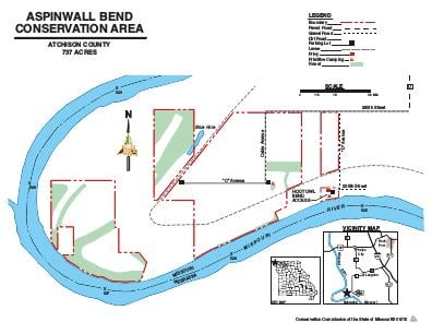
About This AreaThe United States Army Corps of Engineers has purchased this area as part of the Missouri River Mitigation Project. The mitigation project has been designed to enhance fish and wildlife habitat along the Missouri River. The area is managed through a cooperative effort between the Corps of Engineers and the Missouri Department of Conservation. The Aspinwall Bend Conservation Area is composed of four separate tracts. The west tract is only accessible from the Missouri River. The nearest boat access to the Missouri River is at the Langdon Bend Access one mile north of the area. A variety of cover types exist on each tract to include forest, cropland, idle fields, and grasslands. There is one small scour hole that contains fish.