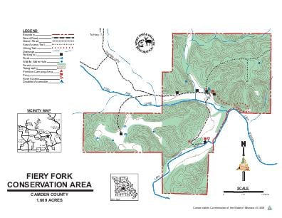
Driving DirectionsFrom Climax Springs, take Highway 7 east 4.30 miles, then take Granger Lane south 2 miles. Watch for signs.
HighlightsThis area is mostly forest. Facilities/features: primitive camping, picnic areas, and two permanent streams (Little Niangua River, Fiery Fork Creek).
About This AreaFiery Fork Conservation Area is in Camden County, 15 miles northwest of Camdenton and seven miles east of Climax Springs, off Highway 7. The area includes 1,509 acres of oak and hickory forest and was named after Fiery Fork Creek, which flows into the Niangua River.During your visit to Fiery Fork Conservation Area, you may view various forest improvement practices designed to improve wildlife habitat, maintain watershed quality, enhance tree growth, quality, and species composition. Signs of disturbance are only temporary and the forest will soon return to normal.Hiking trails on the area vary in length from 0.25 mile to 1.25 miles and offer ideal opportunities to view wildlife in its natural setting.All boundaries of the area are marked from tree to tree with blue paint and are posted where they intersect state and county roads or private lands. Visitors are urged to respect the rights of adjacent land owners.