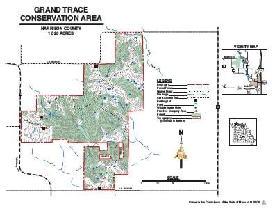
Driving DirectionsFrom the west end of Main Street in Bethany, take Route W north 2.50 miles, then Route F west 5.50 miles to the west entrance of the area.
HighlightsThis area is a mixture of forest, old field, savanna, and grassland habitat. The area features primitive camping and two fishable ponds.
About This AreaThis area is tucked away in what was once an expansive sea of prairie. The area was rich with wildlife, such as deer, buffalo, turkey, and prairie chickens.Indian hunting camps were common here and Indian trails crisscrossed this wild and beautiful country. One main trail, the Grand Trace, connected the small, seasonal villages of the area with the St. Louis trading center, located at the confluence of the Missouri and Mississippi rivers.The Conservation Department purchased this area in 1979 from a grain production corporation. Subsequent acquisitions have increased the area to to it's current size.Since the time of settlement around 1840, the timber of the region has repeatedly been cut over, grazed, and burned. Grand Trace Conservation Area now consists of about half woodland; most of it on the area's steeper slopes and along small creek bottoms. The remainder of the area is open fields, which are managed with farming, haying, prescribed burning, and food plots. Woodland management is also practiced on the area.This conservation area was acquired in part through the Pittman-Robertson Wildlife Restoration Act administered by the U.S. Fish and Wildlife Service.