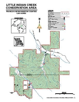
Driving DirectionsNorth entrance: From Highway 30, take Route K south across the Meramec River, then Old Route K left 0.50 mile, then Little Indian Creek Road 3 miles to the area sign.South entrance to new shooting range: From I-44, take Highway 185 south 7 miles, then Route A east 6 miles to the area sign.
HighlightsThis is a forest area. Facilities/features: primitive camping, firearms range (includes shotgun), small fishing pond, and a permanent stream (Little Indian Creek).
About This AreaThe Conservation Department purchased this property in 1978 from Oscar and Eloise W. Johnson, who had owned the land since 1928.Before becoming a conservation area, the land was primarily used for pasture and timber production. Bottomland fields and some upland fields were row cropped and hayed.