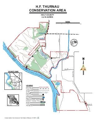
Driving DirectionsFrom Craig, take Highway 111 west 4 miles, and Annapalis Road south 0.50 mile.
HighlightsThis area is a mix of forest, old field, cropland and wetland.
About This AreaThe Conservation Department purchased 366 acres in 1965 to preserve unique wetlands and habitats associated with the Missouri River and to provide public lands and recreational opportunities in northwest Missouri. The United States Army Corps of Engineers has purchased additional acres as part of the Missouri River Mitigation Project. The mitigation project has been designed to enhance fish and wildlife habitat along the Missouri River. The area is managed through a cooperative effort between the Corps of Engineers and the Missouri Department of Conservation.Early exploration and settlement of this area began with the Lewis and Clark expedition in 1804. Journal entries from that expedition mentioned an abundance of wildlife along the broad marshlands of the heavy bottomland timber near the Missouri River.This area was part of the Platte Purchase, arranged by the U.S. government with the Indians in 1836.This area is managed for a wide range of game and non-game wildlife species and is available to the public for a variety of outdoor activities. Management of the open fields includes farming and controlled burning, plus developing wildlife habitat by tree, shrub and grass plantings, wetland management, and selective harvesting of timber.