 Written by HLRBO Staff|
Last updated
The government used to do a pretty good job with mapping our country. For decades, the official U.S. Geological Survey and U.S. Forest Service paper maps were as good as it got.
But unsurprisingly, the feds got left behind as companies such as Google, Garmin, and onX digitized analog maps for modern hunters and other outdoor explorers.
With the passage of the Modernizing Access to Our Public Land (MAPLand) Act in 2022, the government charted a course to play catch-up. Now, four years later we’re starting to see some of the fruits of that labor.
In May, the Department of the Interior announced the release of a series of standardized datasets with more to come. The Theodore Roosevelt Conservation Partnership said the recent release includes roughly 30,000 entries, mostly related to easements that allow access to public lands through private ones.
To the average hunter, this raw data release isn’t particularly useful, but private platforms such as onX as well as a new government digital mapping platform are already incorporating the new data. When fully updated, the newly released data will offer a single source of truth for vital access location information as well as seasonal closures and permitted activities, i.e. shooting, hunting, fishing, boating, etc.
As many hunters know, this information is often surprisingly hard to find, forcing public land users to call local authorities or dig through government agency brochures. This regulatory and boundary confusion is what created an opportunity for onX (land ownership and borders) and startup Hunterizer (hunting regulations app).
“This regulatory and boundary confusion is what created an opportunity for onX and startup Hunterizer — and it’s exactly what the MAPLand Act is trying to fix.”
A New Digital Map Platform. So What?
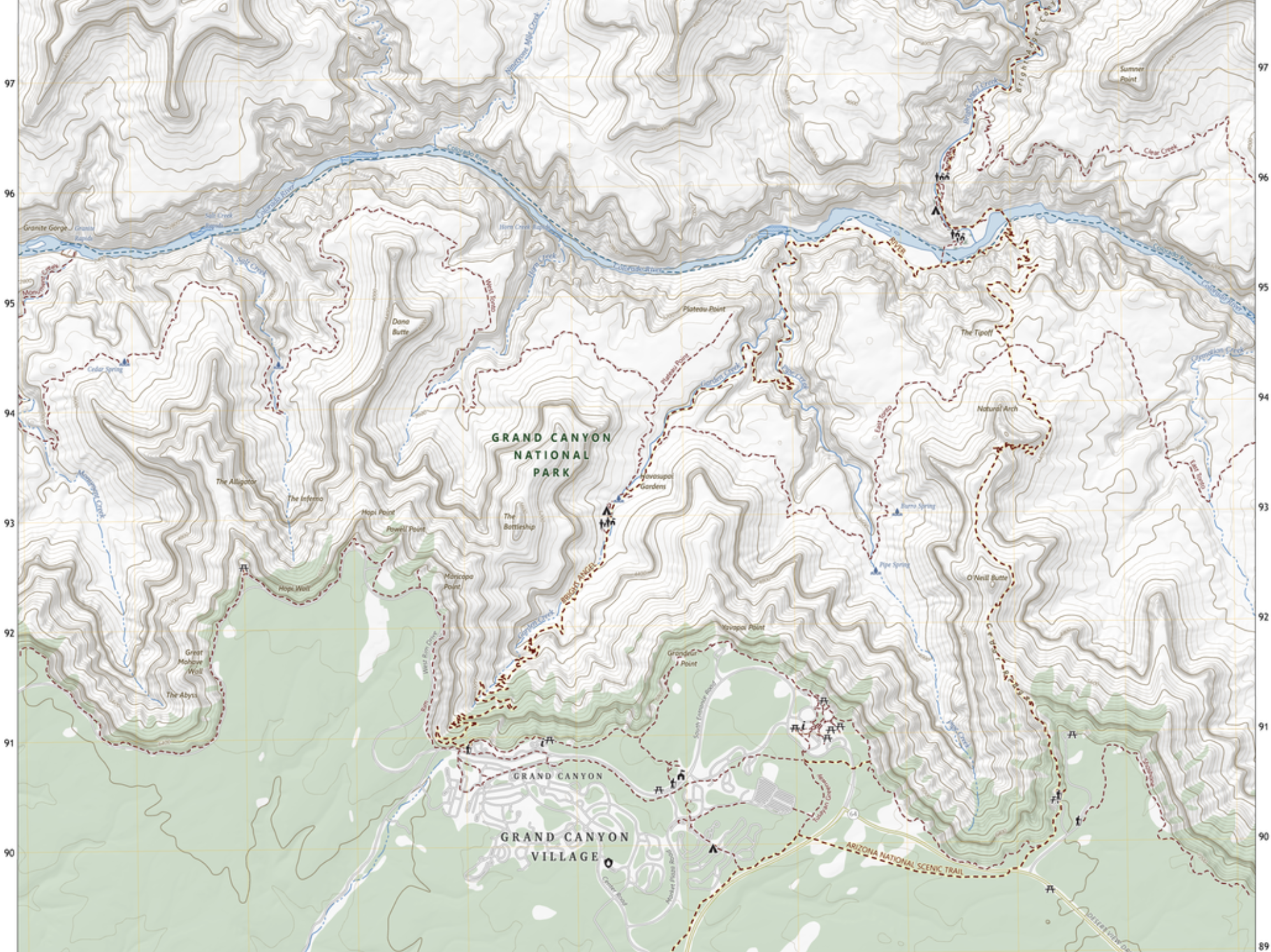 A screenshot of the MAPLand Viewer, the new federal public land access mapping platform.
The feds simultaneously announced a new cross-agency digital mapping platform that promises a public alternative to private platforms such as onX, CalTopo, and others. The biggest news is the release of standardized GIS data for use by any developer, but the new MAPLand Viewer could be an interesting alternative to paid and freemium mapping platforms.
It’s easy to assume that a government-run mapping platform coming out 20 years after Google Maps will be too little too late, but the feds have long done a decent job with mapping, even digital options. The problem has been the lack of data consistency across agencies which often left out access and recreation information in favor of pure geospatial data. The terms of the MAPLand Act promise to rectify that and bring rec information and map data from multiple agencies under one roof.
Whether you pay for CalTopo or use the free MAPLand Viewer, the additional data should provide clarity on how to legally access public lands — which is a win for everyone.
We asked onX representatives if they had incorporated the newly released government easement datasets and the short answer is: they’re working on it. The company said that, wisely, they’re making sure any new additions have been checked for accuracy and clarity on what they mean for end users.
You can see the need for due diligence if you view easements from the new data in the MAPLand Viewer. Click on any one of them and it quickly becomes clear you need more information than what’s listed. An easement appears in dark blue on the map, but click to learn crucial information such as seasonality or permitted modes of travel and legal activities and you realize that map data isn’t actionable.
If you’re just curious about easements and the new data in general, it’s fun to click around the mapping platform, but it’s obvious there’s some work to be done to go from this release of raw GIS data to meaningful tools for hunters.