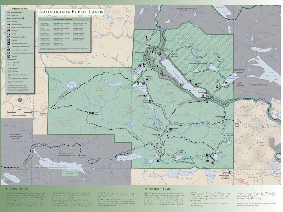
Hikers, campers, hunters, fishermen, snowmobilers and paddlers all enjoy the rugged hills, abundant wildlife and clear waters of this remote region southwest of Baxter State Park. The Nahmakanta Public Lands encompass 43,000 acres of sprawling forests and low mountains (the largest stands at 2,524 feet). Numerous streams and brooks course down steep slopes and run through narrow gorges. Within Nahmakanta's boundary lie 24 "great ponds" (10 or more acres in size) and more than 50 miles of undeveloped shoreline.
An extensive network of hiking trails leads visitors along lakeshores, up to open ledges, and past popular attractions like Tumbledown Dick Falls and Pollywog Gorge, a mile-long gorge with sheer walls that rise 180 feet. The Nahmakanta portion of the Appalachian Trail (AT) lies within the upper reaches of the 100-Mile Wilderness, considered by many to be the AT's most remote section (though not a designated "wilderness area").
During warm weather, ATV riders explore a network of shared-use roads. Fall months draw hunters in search of moose, bear, grouse and deer. In winter, snowmobiles traverse Nahmakanta Public Lands along designated trails such as ITS 85/86 (which links Millinocket and Greenville).
Within the Nahmakanta Public Lands is the State's largest Ecological Reserve, an 11,802-acre expanse that includes much of the property's 9,200-acre roadless area (known as the Debsconeag Backcountry). The State's Ecological Reserve designation ensures that sensitive plant communities will remain in their natural condition and be monitored over time.
The Nahmakanta Public Lands lie in the heart of a diverse complex of approximately 500,000 conserved acres that runs from Katahdin Iron Works in the south to Baxter State Park in the north.