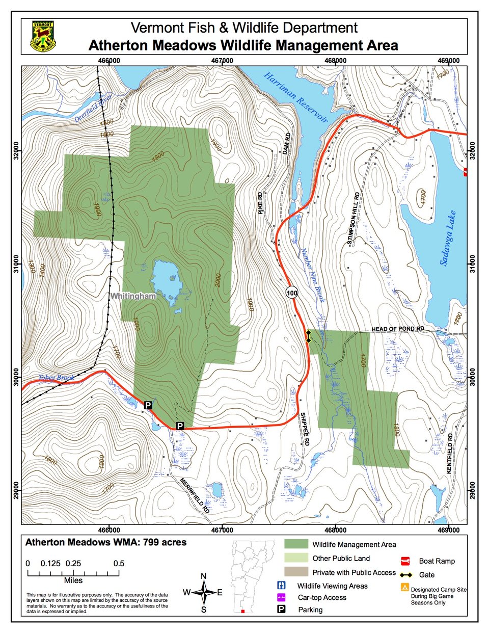
Atherton Meadows Wildlife Management Area (WMA) is located in the town of Whitingham approximately 8 miles west of the village of Jacksonville. The property consists of two separate parcels situated on either side of Route 100. The larger parcel, 646 acres, lies between Route 100 and the southern end of Harriman Reservoir. The northwest boundary of this parcel abuts power company (USGen) land, which is also open to the public via Vermont Land Trust conservation easements. This parcel can be accessed from a parking lot located along Route 100 on the south end of the property, or from a trailhead maintained by USGen at Harriman Dam on the north end of the parcel.
The smaller 153-acre parcel is located southeast of Route 100. To access this piece, it is best to park on the shoulder of the “Head O the Lake Road” which bisects it. Both parcels, totaling 799 acres, are owned in fee simple by the State of Vermont and managed by the Vermont Fish & Wildlife Department.
The topography of the Atherton Meadows WMA is quite variable. The elevation at Route 100 is 158 feet – the lowest on the parcel. An old beaver pond sits in the center of the parcel at an elevation of 1,840 feet.The hills surrounding it, which average 2,000 feet in elevation, create the impression of standing in the bottom of a bowl.
Approximately 120 acres of the 646-acre parcel is a mixed hardwood/softwood forest type; the remaining acreage is predominantly northern hardwoods. Virtually the entire parcel is forested. In some areas apple trees are scattered in the understory, remnants of previous agriculture. Beech and black cherry are the predominant mast-producing trees.
Wintering deer use 120 acres of softwood forest on the property. There is abundant evidence throughout the area - tracks, trails, beds, bark scars and browsing can all be observed. This wintering habitat is completely contained within the boundaries of the WMA and is utilized by deer throughout the winter months.
The large beaver flowage located in the middle of the 646-acre parcel, and the alder swamp associated with No. 9 Brook (which bisects the 153-acre parcel), provide rich habitats for a variety of furbearing mammals and waterfowl. In 1990, several food plots were cut adjacent to the beaver pond in order to encourage the beavers to continue to occupy the drainage. At the same time, several small patch cuts were undertaken in order to enhance grouse, woodcock and snowshoe hare habitat east of the beaver flowage.