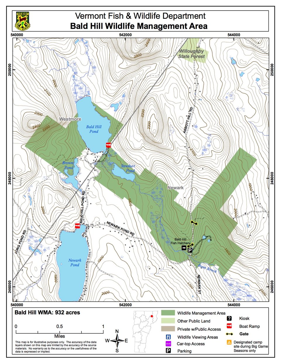
Bald Hill Wildlife Management Area (WMA) is a 932- acre tract of land surrounding the Bald Hill Fish Culture Station. It is owned by the State of Vermont and managed by the Vermont Fish & Wildlife Department. The area is located in the middle of Vermont's Northeast Kingdom region, in the towns of Newark (Caledonia County) and Westmore (Orleans County) between the villages of West Burke and Island Pond.
Access the southern end of the WMA by parking at the Fish Culture Station. Bald Hill Pond Fishing Access is at the end of Bald Hill Pond Road.
The WMA is located in a high basin, with elevations ranging from 2,400 feet on the steep sides of McSherry Mountain to 1,500 feet in the southeast corner along Bean Brook. Forest cover on the hillsides is primarily sugar maple, beech, black cherry, yellow and paper birch. A dominant feature is Bald Hill Pond, a 105-acre pond that lies almost entirely within the WMA. Sawdust Pond and Brown's Pond are much smaller ponds located in and adjacent to the WMA. These ponds are the result of poor drainage caused by thick glacial deposits. Bean Brook drains these ponds southeast (towards the hatchery) through beaver ponds and gently sloping wetlands forested by red spruce, balsam fir, white cedar and alder swales.
Approximately 30 acres of brushy old-field habitat lies north of the fish culture station. This habitat is maintained by periodic mowing to maintain berry and nut-producing shrubs. Other habitat improvements include maintenance of an herbaceous opening, pruning and release of wild apple trees, and periodic timber management to regenerate softwood forest for snowshoe hare habitat.