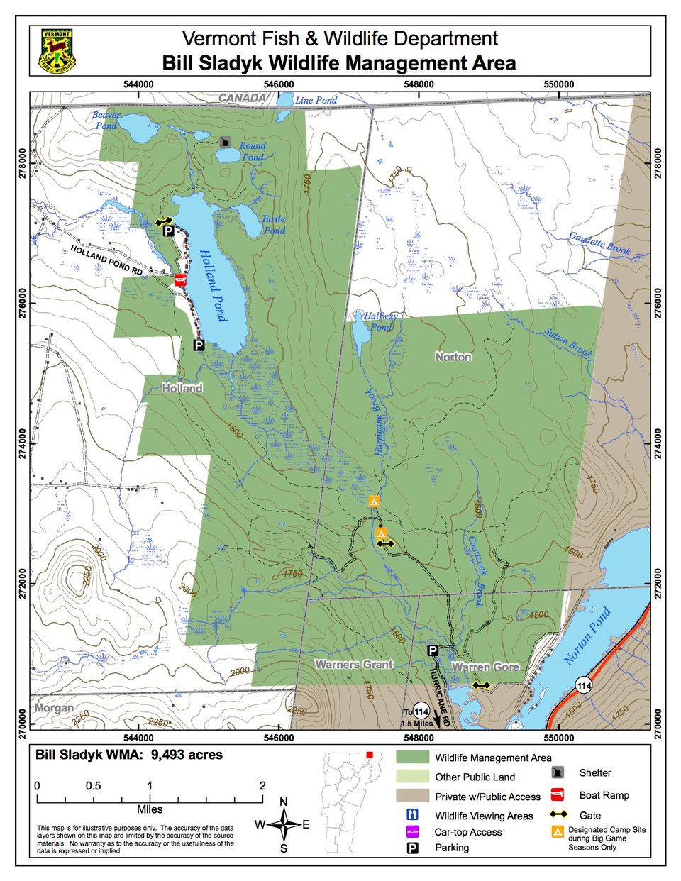
Bill Sladyk Wildlife Management Area (WMA) is a , -acre parcel of land owned and managed by the Vermont Fish & Wildlife Department. The WMA is located eight miles north of Island Pond on Route 114. It ranges from Norton Pond northwest to the Canadian Border just north of Holland Pond.
Access the western side of the WMA from Holland Pond Road. There is a boat access on the pond and also parking at the northern end of the pond. The WMA can be accessed from the southeast from Hurricane Brook Road where there are parking areas and a wildlife viewing area.
Elevations on the WMA range from 1,400 feet along Hurricane Brook to 2,000 feet on Beechnut Ridge. The terrain varies from flat cedar swamps to rolling hardwood hills. The property is nearly 100% forest, which is comprised of red and sugar maple, American beech, yellow and paper birch, black cherry, red and black spruce, balsam fir and white cedar.
Since acquiring the property, the Department has undertaken many different projects to enhance the value of the land for wildlife. Several older log landings were planted and are periodically brush-hogged to provide openings in the heavily forested landscape. An 85-acre unit located in the vicinity of the Ben Cole Clearing has been managed with the primary goal of creating optimum grouse habitat. The Department has also been actively restoring an historical deeryard along Coaticock and Hurricane Brooks.
A diversity of excellent wetland habitats can be found throughout the WMA. Two wetlands of ecological significance include Cranberry Bog and Halfway Pond. Cranberry Bog is a 26-acre peatland bog with stunted tamaracks, black spruce, and the carnivorous pitcher plant. Halfway Pond is one of the most pristine spruce-lined ponds in Essex County. The WMA also contains many scattered beaver impoundments and small brooks, the 334-acre Holland Pond, and the smaller Beaver, Duck, Round, Line and Turtle Ponds.