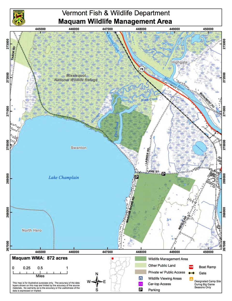
Maquam Wildlife Management Area (WMA) is located in the town of Swanton in northwestern Vermont. It consists of 872 acres, some of which is south of Route 36 west of town. The remainder is along the lakeshore northwest of Route 36. The land is owned by the State of Vermont and managed by the Vermont Fish & Wildlife Department.
Maquam WMA is located in the Champlain Valley and has both upland and wetland environments. First Creek and Maquam Creek are slow moving streams at lake level. The WMA is adjacent to the Missisquoi National Wildlife Refuge (NWR), which includes an extensive delta. Together, the WMA and NWR conserve the largest wetland complex on Lake Champlain. The Lampman parcel acts as an important travel corridor for wildlife moving to and from Missisquoi NWR.
The wetland portions of the WMA have several different components. Besides open water, there are deep broad-leaf, wild rice and cattail marshes. There are some shrub swamps, including a rather unusual sweet gale shoreline swamp. There are buttonbush swamp and red or silver maple-green ash swamp. Some ancient sand dune ridges rise above the surrounding wetlands and support black gum at the northern edge of its range. Winterberry, leatherleaf and red-osier dogwood also grow on the dune ridges. The upland habitats include a lakeside floodplain forest and maple-ash-hickory-oak forest. Because part of the WMA used to be farm fields, some of the forest is early successional, growing such trees as eastern cottonwood and aspen and willow species.
There are several rare and endangered species present on Maquam WMA. Small beggar’s tick, yellow water- crowfoot, small bidens and Virginia chair-fern are herbaceous plant species that occur. Endangered ospreys, bald eagles and black terns all occur in nearby Missisquoi NWR, and are sometimes seen in the WMA. It is against the law to disturb any threatened or endangered species, either plant or animal. Please use binoculars and keep your distance.