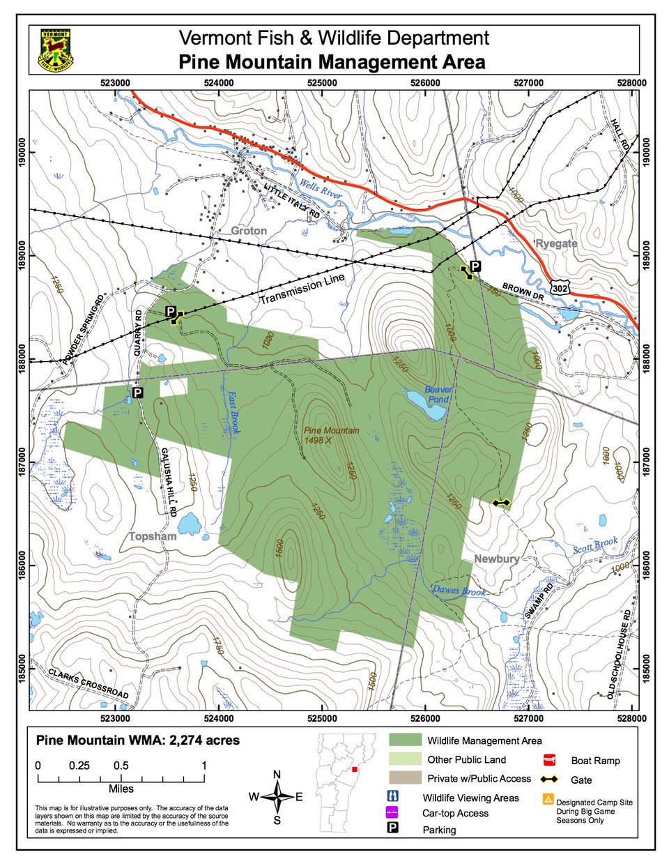
Pine Mountain Wildlife Management Area (WMA) is located at the intersection of the east central Vermont towns of Groton, Ryegate, Newbury and Topsham. The WMA is 2,274 acres in size. It is bounded by Route 302 and the Wells River to the north, Powder Spring Road to the west, Melvin and White Hills to the east, and Burnham Mountain to the south. The WMA is owned by the State of Vermont and managed by the Vermont Fish & Wildlife Department.
Access can be gained from several entry points off Powder Spring Road, Galusha Hill Road, and the abandoned Montpelier & Wells River railroad bed that begins on the Little Italy Road in the village of Groton. Developed parking lots are located on the entry road off Galusha Hill Road (a.k.a. Quarry Road) at the gate/powerline intersection, as well further south on Galusha Hill Road adjacent to the open fields. Undeveloped parking exists off the railroad bed at its intersection with the VAST trail, which is gated during non- snow months.
The WMA lies within the Wells River watershed. Elevations range from approximately 1,500 feet to 720 feet. The land is now 95% forested, with a mix of hardwood trees including red and sugar maple, yellow birch, beech, white ash, black cherry, red oak, hophornbeam and basswood. Softwood trees such as balsam fir, red spruce, hemlock, white pine and white cedar are also present. The coniferous areas west of Galusha Hill Road and northwest of Melvin Hill provide wintering habitat for white-tailed deer. About 40 acres of field along Powder Spring and Galusha Hill Roads are kept open, via lease agreements, by brush hogging and haying. Scattered apple trees occur within those fields, which are maintained by release cuttings.
The WMA is home to several examples of local and State-significant natural communities such as: lowland spruce-fir forest; mesic northern hardwood forest; rich northern hardwood forest; white pine-northern hardwood forest; mesic red oak-hardwood forest; hemlock forest; hemlock-yellow birch forest; northern hardwoods talus woodland; dry oak-hickory-hophornbeam forest; poor fen; northern white cedar swamp; and various successional communities. Many rare, threatened and endangered plants are associated with these natural communities.
Five permanent streams flow through the WMA; all drain into the Wells River. These include Keenan, East and Dawes Brooks. An excellent variety of wetland habitats can be found throughout the WMA and are often associated with the stream drainages. Many of these wetlands are influenced by beaver activity. The variety of terrain, wetlands, natural communities, field openings and stream drainages provides habitat for a variety of plants and animals, making Pine Mountain WMA a unique place for the public to enjoy wildlife-related activities.