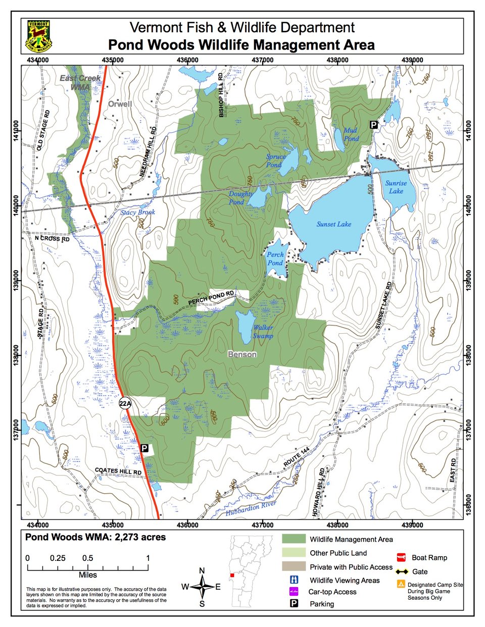
Pond Woods WMA is a 2, -acre parcel owned by the State of Vermont and managed by the Vermont Fish & Wildlife Department. The majority of the WMA lies in the town of Benson with five acres in Orwell. The parcel can be accessed from several points, including the east side of Route 22A, Perch Pond Road, Bishop Hill Road, and the west side of Pond Woods Road. There is a pleasant picnic area on the east side of Route 22A just south of Perch Pond Road.
The Vermont Fish & Wildlife Department owns only the timber rights on approximately 400 acres of this WMA. Please be respectful of the private in-holdings located between Cranberry and Walker Swamps.
Pond Woods WMA has excellent diversity of upland and wetland natural communities. Located near the northeast corner of the WMA, Mud Pond is a long, narrow 12-acre pond bordered by steep slopes on the east and west. A poor fen, an open, acidic peatland dominated by sphagnum mosses, sedges and heath shrubs, occupies less than one acre at the north end of the basin. Poor fens, which are rare in Vermont, are closely related to bogs but have some mineral enrichment. Adjacent to Mud Pond is a stunted woodland of pitch and white pine, and white and red oak. Twenty five-acre Spruce Pond is bordered by less steep slopes forested with red oak and eastern hemlock. Peatlands are to the north and south of the open water. The northern peatland is a combination of fen and lakeside bog. Connected by the southern peatland, Doughty Pond is smaller in size than Spruce Pond, and has a bog at its southern end.
Bishop Hill, with an elevation of 823 feet, is just west of Spruce and Doughty Ponds. Oak Hill, located west of the southern portion of Doughty Pond, is 887 feet. Both hills and nearly all of the WMA are forested with a mix of red and sugar maple, yellow birch, beech, red oak, hickory and hemlock. The southern portion of the WMA is lower in elevation and contains Cranberry Swamp, a poor fen, to the east and Walker Swamp to the west. The swamps have varying degrees of open water and have much aquatic vegetation. Cranberry Swamp Hill is a dry oak-hickory forest. A deer wintering area is located near Cranberry Swamp.