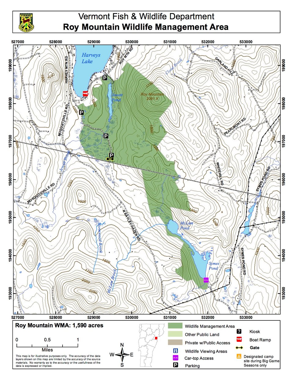
Roy Mountain Wildlife Management Area (WMA) is a 1,590-acre parcel of land owned by the State of Vermont and managed by the Vermont Fish & Wildlife Department. The WMA is located within the towns of Barnet and Ryegate, and ranges from the top of Roy Mountain, west to Jewett Pond, and south to the shores of Upper and Lower Symes Ponds. Use the parking area on Roy Mountain Road for foot access. Lower Symes Pond boat access is off Hunt Mill Road in Ryegate.
Elevations on the WMA range from 900 feet to 2,091 feet atop Roy Mountain. The terrain varies from flat cedar swamps to steep pine-hemlock slopes along the mountain. The property is mostly forested. Major tree species are red and sugar maple, yellow birch, beech, hemlock, red oak, red pine, white pine and white cedar. Several old fields with scattered apple trees, testaments of past farming, are located around the Dekoyer Place.
Wetland habitats throughout the WMA are diverse. The most notable of these are a cattail marsh, a large forested wetland along Jewett Brook, and shrub borders around the ponds scattered across the WMA. Two areas of ecological significance occur on the WMA. One is a 200-acre area on top of Roy Mountain that is dominated by red pine. This old-growth stand is one of the few natural red pine stands in Vermont. The other is a wetland containing the largest known population of sheathed sedge in the State.