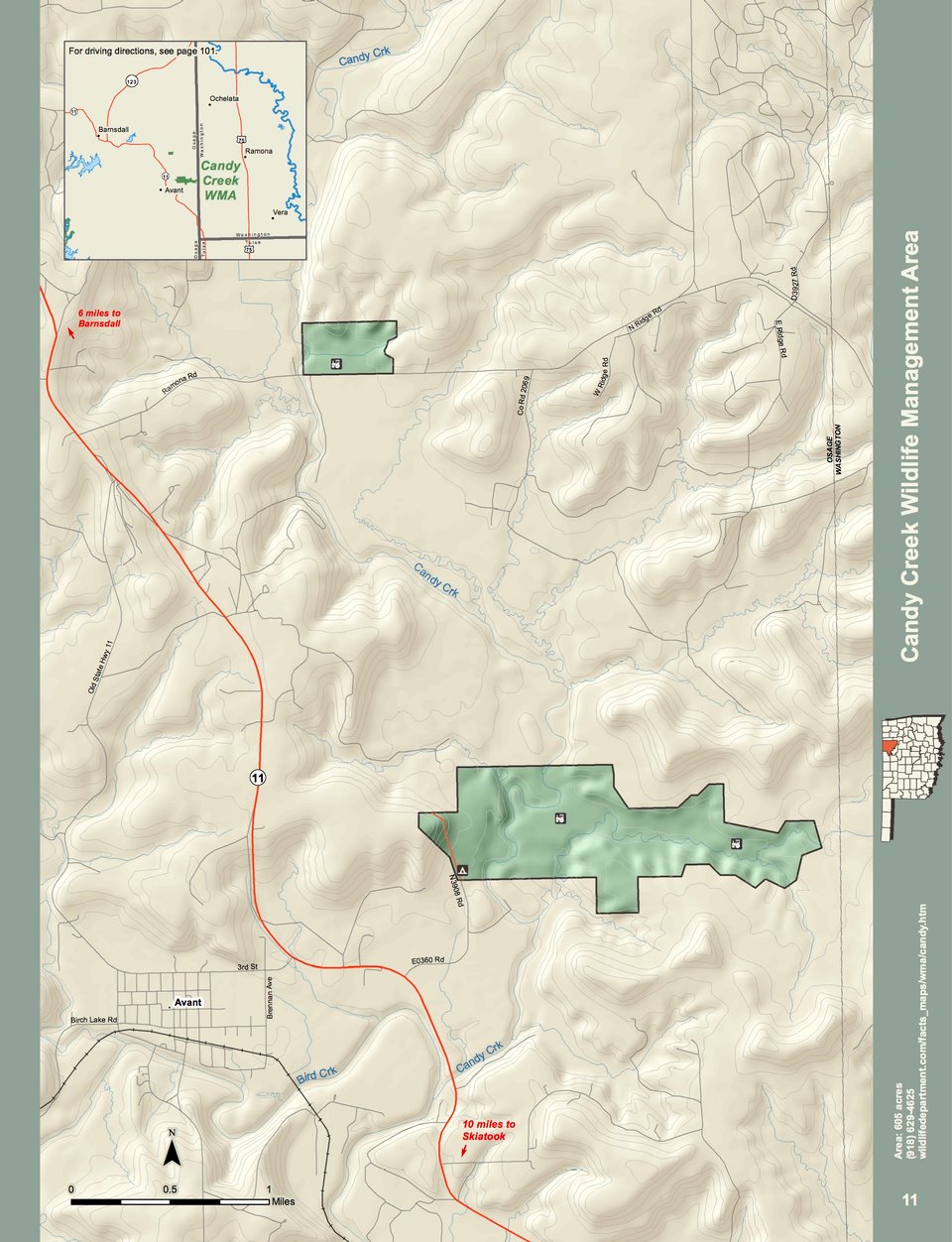
Candy Creek WMA is comprised of 605 acres in far eastern Osage County, just northeast of the town of Avant. In the 1970s, the US Army Corps of Engineers purchased lands along Candy Creek to be part of a flood control reservoir. After the land was condemned and purchased, problems arose that prevented reservoir construction. After many years of the land being idle, the federal government offered the original landowners or their heirs the opportunity to repurchase their land. Eighty percent of the land was repurchased by former landowners. The remaining two tracts were deeded to the Department via the National Park Service’s Lands to Parks Program.
Candy Creek WMA has a great deal of vegetative diversity. The north tract, on the north side of the county road known as “Ramona Road”, just east of the Candy Creek bridge, is 74 acres of a mix of tallgrass prairie, upland timber-mainly post oak, bottomland timber-pecan dominant, and two old crop fields. Initial plans call for the crop field adjacent to the county road to be developed for dove hunting opportunities. The south tract has sandstone based soils on the west end, with post oak timber being dominant. In the low elevations that were going to be the bottom of the lake, rich bottomland soils occur. Much of this acreage was formerly introduced pasture, this acreage will be converted to habitat in the future. As you transition up in elevation, there are more areas of post oak timber with a limestone substrate. Highest elevations have very shallow limestone soils and are dominated by tallgrass prairie.
WMA Driving Directions: From Avant: ¾ mile east on State Hwy 11, left (northeast) on access road, ¾ mile to entrance.