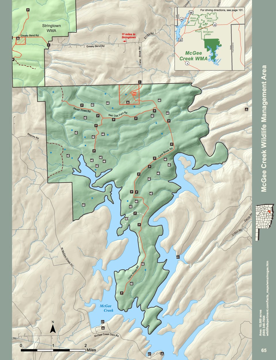
McGee Creek WMA covers 10,000 acres of southcentral Atoka County of the southeastern part of Oklahoma. Located 11 miles east of Stringtown on Greasy Bend road, terrain within the WMA ranges from steep to moderately steep. Vegetation consists of oak-pine association. The average precipitation of the area is about 52 inches annually.
WMA Driving Directions: From Stringtown: From the junction of U.S. Hwy 69 and State Hwy 43, go .06 miles east to “Y” and turn right, 11 miles on Greasy Bend Rd to sign, turn right, 1 mile to headquarters on Cane Break Rd.