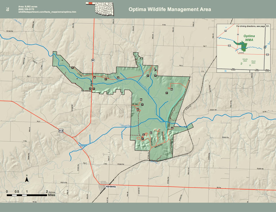
Optima WMA covers 8,062 acres of eastern Texas County in the Oklahoma panhandle. Located just north off Hwy. 412 (northwest of the town of Hardesty), Optima WMA is a mixture of upland and river bottom.
Sagebrush and buffalo grass predominate on upland sites, which are interspersed with sand plum thickets. Bottomlands consist of sand plum thickets, salt cedar and mixed grassland. The Beaver River, which is dry, offers a classic western Oklahoma floodplain comprised of cottonwood trees. The average annual precipitation for the area is about 17 inches.
WMA Driving Directions: From Hardesty: 3 miles west on U.S. Hwy 412, 3 miles north on State Hwy 94.