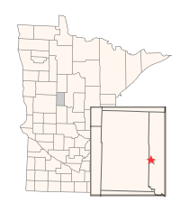
Directions: From the junction of Co. roads. 227 & 26 on the S side of Nimrod, S on CR 26 4 miles, E on Co. Rd. 9 4 miles, S on Co. Rd. 30 2.8 miles, E on gravel forest trail 1 1/4 miles to Dry Sand Lake access. Description: Dry Sand WMA was created in 1958 to restore/improve waterfowl habitat in the drained Dry Sand Lake basin. Initial water control structure was installed in 1964 and re-constructed in 2000.