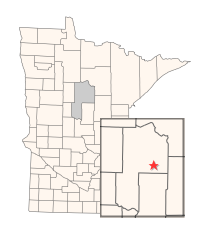
Directions: From the junction of CR 58 and St. Hwy. 6 in Outing, N on St. Hwy. 6 2.2 miles, W on Co. Rd. 48 5.2 miles, N on Co. Rd. 55 5 1/4 miles to forest trail in SW corner of Co. Rd., W on forest trail 1.5 miles then S 1/2 miles to waterfowl impoundment. Description: This WMA was created in 1970 for the purposes of improving waterfowl habitat in the upper headwaters of Daggett Brook through the construction of a 1,000' dike and related water control structure that has created a 230 acre impoundment.