Driving DirectionsFrom Hannibal, take Highway 79 south 17 miles, then Route TT east to the area.
HighlightsThis area contains about 4,000 acres of flooded wetlands. Facilities/features: lake boat ramp, stream boat ramp, waterfowl blinds, and two natural areas (Bur-Reed Slough and Oval Lake). There are also more than 500 acres of fishable water, including Horseshoe Lake (70 acres), Salt River, and the Mississippi River.
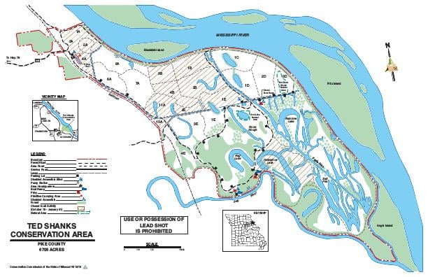
About This AreaThis 6,705-acre area contains bottomland hardwood timber, open marsh, mixed shrub/scrub/emergent wetlands, row crop, oxbow lakes and sloughs, old fields, and upland woods. The area consists of 3,827 acres of MDC lands and 2,878 acres of lands managed under a cooperative agreement between the Conservation Department, U.S. Fish and Wildlife Service and U.S. Army Corps of Engineers.Pittman-Robertson funds from the federal excise tax on sporting arms and ammunition were used for 75% of the purchase cost of the original area. The area was acquired in 1970 to 1971.Ted Shanks Conservation Area borders 8.75 miles of Mississippi River frontage, 4.75 miles of the Salt River and 2.25 miles of river bluffs.Zebulon Pike charted the mouth of the Salt River in 1805. The area was a hunting and battle ground for Sac and Fox Indians from the north and the Osages from the south. The land was granted to Saucier in 1799 and in turn to his son-in-law's brother, Auguste Chouteau (one of the founders of St. Louis), then to Neree Valle (associated with the founding of Ste. Genevieve).The area contains 35 miles of levees, two pump stations, nine miles of water canals and 45 water control structures. The area is divided into 19 management units.