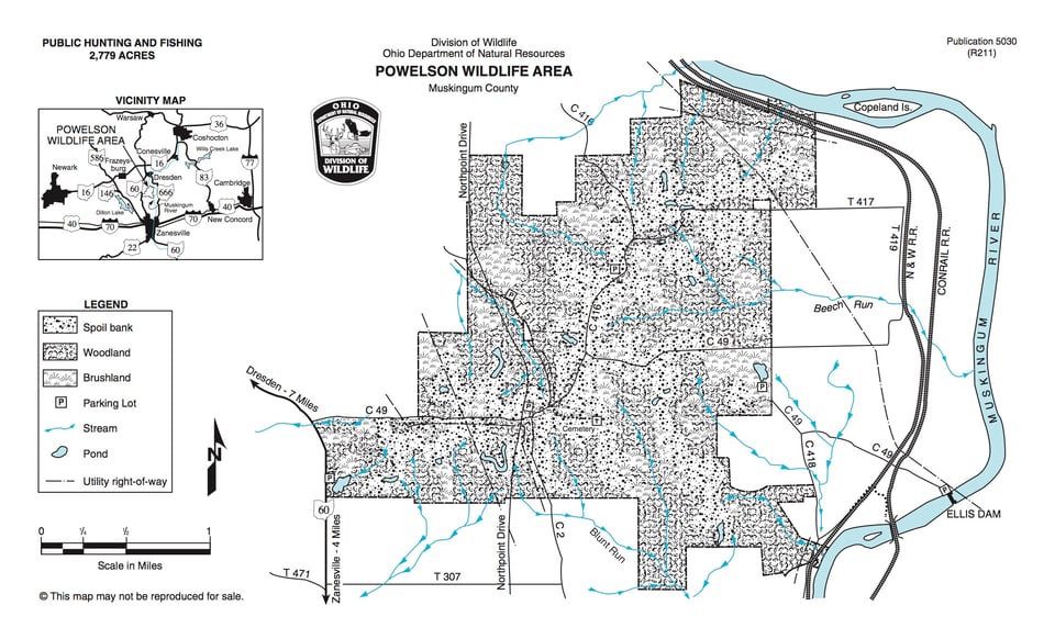
This 2,779-acre wildlife area lies between State Route 60 and the Muskingum River, four miles north of Zanesville. County Road 49, which runs east from State Route 60, provides the best access to the heart of the area.
The topography includes gently rolling, reverting old fields and woodland. Seventy-six percent of the land is covered by woodland; of the total, 40 percent is in sawlog-size stands and 60 percent in pole-size stands. Brushland comprises 22 percent of the area. Less than one percent is open land.
Approximately one-fifth of the area has been affected by earlier strip mining, leaving the terrain in a rough condition. In the 1940s some of the spoil banks were planted to black locust and conifers which are now pole size.