McClellan-Kerr WMA covers 7,905 acres in Wagoner, Muskogee, Haskell and Sequoyah counties.
Located along the McClellen-Kerr navigation system the area is mainly river and bottom land habitat with scattered agricultural fields.
WMA Driving Directions:
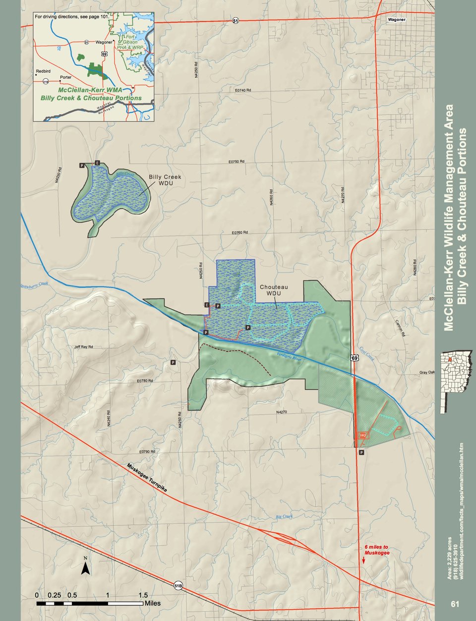
Billy Creek & Chouteau Portions
Billy Creek – From Wagoner: 4½ miles west on State Hwy 51, 1½ miles south on N4230, 1 mile east on gravel access road.
Chouteau – From Wagoner: 2½ miles west on U.S. Hwy 51, 4 miles south on N4250.
From the Highway 10 and Highway 100 junction in Gore, take Highway 10 southeast for approximately two miles. Turn north to WMA. This accesses the east side of the Lower Illinois River (between the Illinois River and “Deep Branch”) portion of McClellan Kerr (RS Kerr) WMA.
McClellan-Kerr WMA: Robert S. Kerr Portion
Harkey Island portion – From Vian: From U.S. Hwy 64 and State Hwy 82 junction, 4 miles east on U.S. Hwy 64, 3 miles south on N4550 to the “T” intersection. Turn west on E1100 and follow into area.
Lower Illinois River portion, west side – From Gore: From junction of State Hwy 100 and U.S. Hwy 64, 1½ miles southeast on U.S. Hwy 64, turn north and continue 0.8 miles to WMA access on east (right).
Lower Illinois River portion, east side – From Gore: From junction of State Hwy 100 and U.S. Hwy 64, 2 miles southeast on U.S. Hwy 64, turn north to WMA.
McClellan-Kerr WMA: Webbers Falls Portion
From Braggs: 2 miles west on E0930.