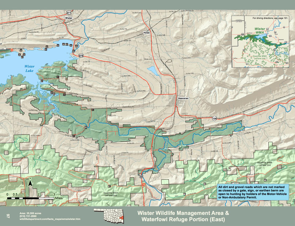
Wister WMA covers 35,500 acres of central Leflore and eastern Latimer Counties in southeastern Oklahoma. Located around the 7,000 acre Wister Reservoir, along and either side of Hwy. 59 and 271 south, south of the towns of Wister and Heavener. The area is a mixture of river bottoms, upland and foothills. Bottomland consists mainly of Oaks and other hardwood species. Upland sites are a mixture of small fields of native grass, greenbrier and sumac. Foothills consist of post oak, hickory and pine. The Poteau and Fourche Maline Rivers run through the east and west portions of the area and offers a good example of bottom land hardwoods floodplain. The average annual precipitation for the area is about 50 inches.
WMA Driving Directions:
Independence Entrance – From Heavener: 5 miles west on Independence Rd.
Conser Landing Entrance – From Hodgen: 5½ miles west on Conser Rd, 1 mile north on CR4695.
Potts Landing Entrance – From Wister: 2 miles east on U.S. Hwy 270, 2 miles south on Glendale Rd, 1 mile west on Potts Mt. Rd.
Britton Bottom Rd Entrance – From Wister: 2 miles east on U.S. Hwy 270, 1½ miles south on Glendale Rd, 1 mile west on Britton Bottom Rd.
Pocahontas Rd Entrance – From Wister: 2 miles west on U.S. Hwy 270, 1½ miles south on 295th Ave (CR149), 1 mile west on Pocahontas Rd, turn west at “Y” and continue ½ mile to WMA sign.
Cedar Creek Rd Entrance – From Wister: 9 miles west on U.S. Hwy 270 (½ mile west of Fanshawe), ¼ mile south on N4550.
Waits Ln Entrance – From Wister: 6 miles west on U.S. Hwy 270, 5.2 miles south on U.S. 271, at
4-way intersection go ½ mile east on CR154 to community of Summerfield, 2.7 miles south and east on Summerfield-Reichert Rd, north on Waits Ln. Rd at WMA sign.
Falls Hole Ln Entrance – From Wister: 6 miles west on U.S. Hwy 270, 5.2 miles south on U.S. Hwy 271, at 4-way intersection go east on CR154 for 1.2 miles to Falls Hole Lane and WMA sign.