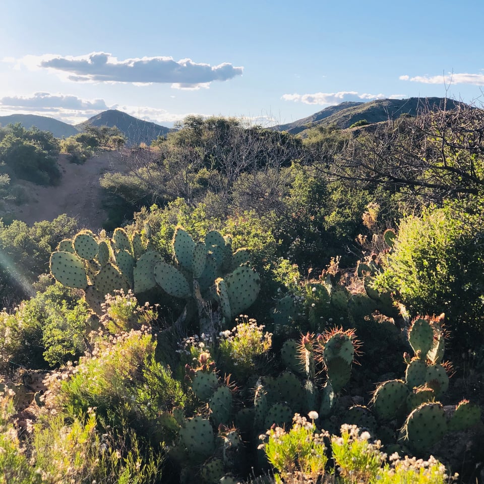
Three square miles of beautiful pristine privately owned high desert wilderness in Aquarius Mountains Northwestern Arizona.
Each square mile is landlocked and surrounded by BLM wilderness. Access is 3 miles to the lowest parcel and 11 miles to the high parcel by a wide, improved dirt road from major highway.
It is 14 miles to town with services including gas, restaurants and motel. Two hour drive between Las Vegas and Phoenix.
Land has seasonal washes and streams, wells with watering holes in vicinity.
Hunting for javelina, and mule deer is popular with bow hunters. Also a wide variety of indigenous fauna, including big game, mountain lion, antelope, bobcat, bear and bighorn.
Remote wilderness property, land has not been grazed or ranched in half a century and is in true pristine condition with no sign of recent human habitation.
Primitive petroglyphs and caves indicate native human habitation most recently by Apache and Mojave tribes.
Elevation ranging from 2500 - 5000 ft elevation.
Located between Phoenix, AZ and Las Vegas, NV off the Highway 93 (future interstate 11.)
Extremely remote -- you can set up a base camp on adjacent BLM land and then access the ranch 4 x 4 jeep trail or a wash by ATV, horse, jeep or on foot.
Access to parcels is is via an improved dirt road or a wash, 3 to 10 miles from highway 93. From this point is is rugged 4 x 4 jeep trail or on foot.
Springs, wells, watering holes and seasonal washes/streams in the area.
Perfect for a primal hunting experience, this is ancient Native land with petroglyphs.
Brilliant starry nights. No sound of civilization or even airplanes here.
Diverse high desert vegetation including pinyon, mesquite, cholla, saguaro, joshua trees, aspen and sycamore with wildflowers in the Spring.
You must be prepared for rugged off grid self sufficient camping with your own ATV or jeep.
Weather is mild year round, and it does not freeze or snow here.
You are guaranteed not to see another human being here -- ranch is surrounded on all sides by wilderness.
It is well known that the desert state has some of the best and most varied big game hunting available in the country.
Primary Game Species/ Hunting Month(s)
Javelina January/February
Mule Deer October/November
Antelope August/September
Secondary Game Species/ Hunting Month(s)
Quail October-February
Game according to the Game Management Unit, include: Bighorn, antelope, javelina, deer, elk, black bear, mountain lion.
Offers you clean, pollution-free air and ideal year-round climate. Mild, sunny, winter temperatures from 40 to 70 F are the norm here with one or two inches of rainfall per month.
The mountain breezes, low humidity and high elevation (3000 to 5000 foot range throughout the canyons and peaks on the land) keep even the hottest summer days pleasantly comfortable.
Terrain is gently rolling at lower elevations and very steep at the high elevations, with dramatic peaks, mesas, hidden valleys and red rock cliff features.
Variety of trees -- from saguaro cactus and Joshua Trees to pinon pine, deciduous sycamore, and aspen.
The views in every direction are of mountains and mesa, with big rock formations.
The Aquarius Mountains are a 45-mi. long[1] mountain range in southeast Mohave County, Arizona. The range lies in the northwest of the Arizona transition zone, and at the southwest of the Coconino Plateau, a subsection of the Colorado Plateau.
The Aquarius Mountains are on the perimeter of the transition zone, and border the south-flowing Big Sandy River and Valley on its west; adjacent further west is the massif of the Hualapai Mountains, a block faulted Basin and Range landform bordered westwards by the north-south Sacramento Valley.
Mohave County and northwest Arizona, is also a southeastwards extension of the Mojave Desert which extends down to Wickenburg, Arizona, on the southwest perimeter of the Arizona transition zone.
Joshua trees can be found here, and the route north from Wickenburg, U.S. Route 93 in Arizona is called the Joshua Tree Highway. The region is at the northwest border of Arizona's Sonoran Desert region of the lower elevation deserts, as they merge northwest into higher elevations of Mohave County.