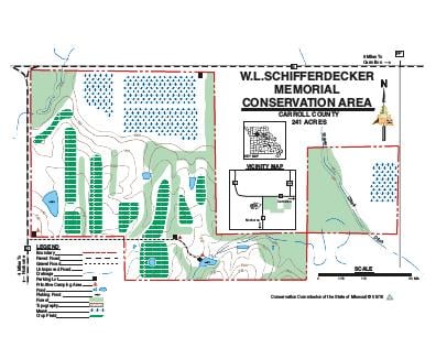
Driving DirectionsFrom Carrollton, take Route E west 10 miles, then Route D south 0.50 mile to area entrance.
HighlightsThis area contains old fields, cropland, two wetland units, grassland, and some forest.
About This AreaThis area was established in 1976, after the Schifferdecker family donated 80 acres and the Conservation Department purchased an additional 160 acres.The area consists of 40 acres of cropland, 20 acres of timber, 100 acres of old fields and hedgerow, 20 acres of native, warm-season grasses, two small wetlands and several small ponds. Turkey Creek crosses a portion of the area.Woodlands, cropfields, and native grasses are managed to provide year-round food and cover for a variety of game and non-game wildlife species. Haying and controlled burning are used to maintain plant diversity in open areas. Habitat plantings include native trees, shrubs, and grasses.